Nashville, TN...Little Rock, AR...Jackson, MS...Clarksville, TN...Murfreesboro, TN...
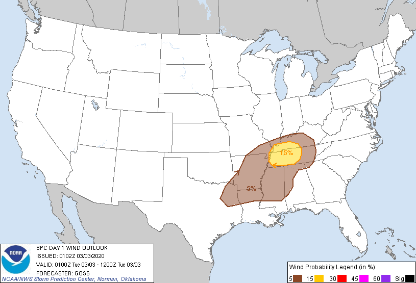
Probabilistic Damaging Wind Graphic
Probability of damaging thunderstorm winds or wind gusts of 50 knots or higher within 25 miles of a point. Hatched Area: 10% of greater probability of wind gusts 65 knots or greater within 25 miles of a point.
SPC AC 030102
Day 1 Convective Outlook
NWS Storm Prediction Center Norman OK
0702 PM CST Mon Mar 02 2020
Valid 030100Z - 031200Z
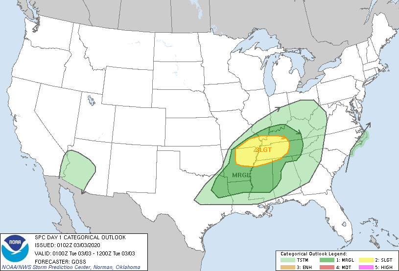
...THERE IS A SLIGHT RISK OF SEVERE THUNDERSTORMS FROM THE ARKLATEX
REGION TO THE MID AND LOWER MS/LOWER OH/TN VALLEYS...
...SUMMARY...
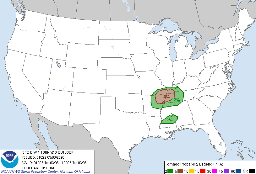
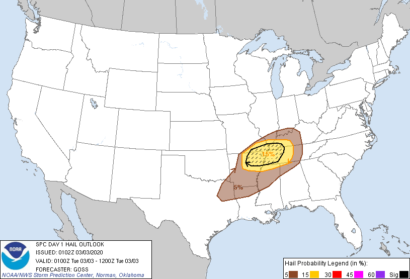
Scattered severe thunderstorms with large hail, a couple tornadoes,
and damaging winds are anticipated across the Mid-South through
tonight.
...Arklatex to the mid and lower MS/lower OH/TN Valleys...
Thunderstorms have developed late this afternoon/early this evening
from far northern Arkansas/southern Missouri eastward to western
Kentucky, near a weak surface low analyzed over southeastern
Missouri and the associated warm/cold fronts. Supercell wind
profiles are observed across the region, while broken cloud cover
from parts of Arkansas eastward aided modest/prior heating -- and
thus development of 500 to 1000 J/kg mixed-layer CAPE.
Given the environment, a few rotating storms have evolved, with
attendant severe weather being reported locally. With time, as the
low shifts eastward and the cold front sags southeastward across
Arkansas and the Arklatex region, additional/scattered storm
development is expected. While instability is lesser to the south
-- owing to denser cloud cover which persisted through the day --
ample shear suggests a few severe storms may evolve from northeast
Texas eastward across Mississippi and western Alabama this
evening/overnight. However, greatest severe potential should remain
farther north -- focused from northeast Arkansas and southeast
Missouri eastward across the Mid South/Tennessee Valley area.
..Goss.. 03/03/2020
CLICK TO GET WUUS01 PTSDY1 PRODUCT
NOTE: THE NEXT DAY 1 OUTLOOK IS SCHEDULED BY 0600Z