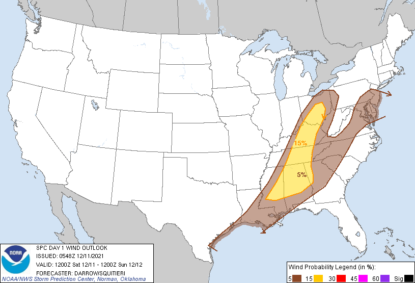
Probability of damaging thunderstorm winds or wind gusts of 50 knots or higher within 25 miles of a point. Hatched Area: 10% of greater probability of wind gusts 65 knots or greater within 25 miles of a point.
SPC AC 110548
Day 1 Convective Outlook
NWS Storm Prediction Center Norman OK
1148 PM CST Fri Dec 10 2021
Valid 111200Z - 121200Z
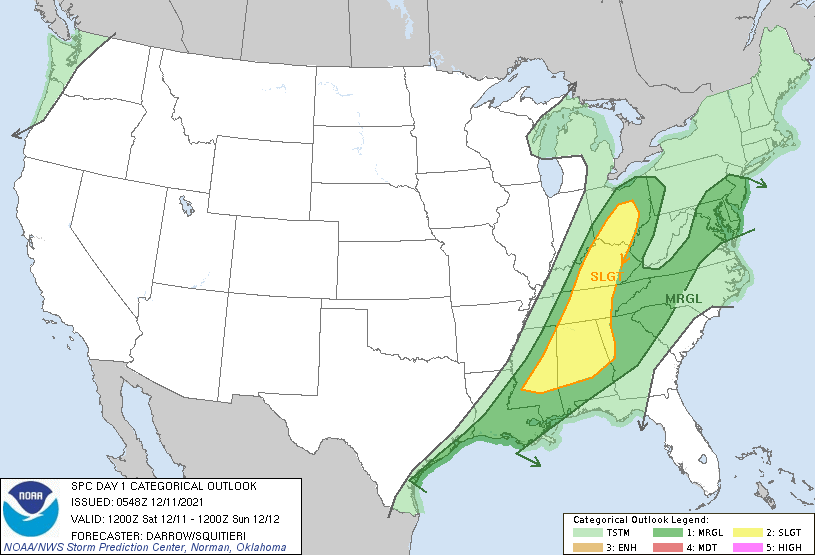
...THERE IS A SLIGHT RISK OF SEVERE THUNDERSTORMS FROM THE OHIO
VALLEY TO THE NORTHERN GULF STATES...
...SUMMARY...
Isolated strong to severe thunderstorms remain possible from the
Ohio/Tennessee Valleys into the northern Gulf States. Damaging wind
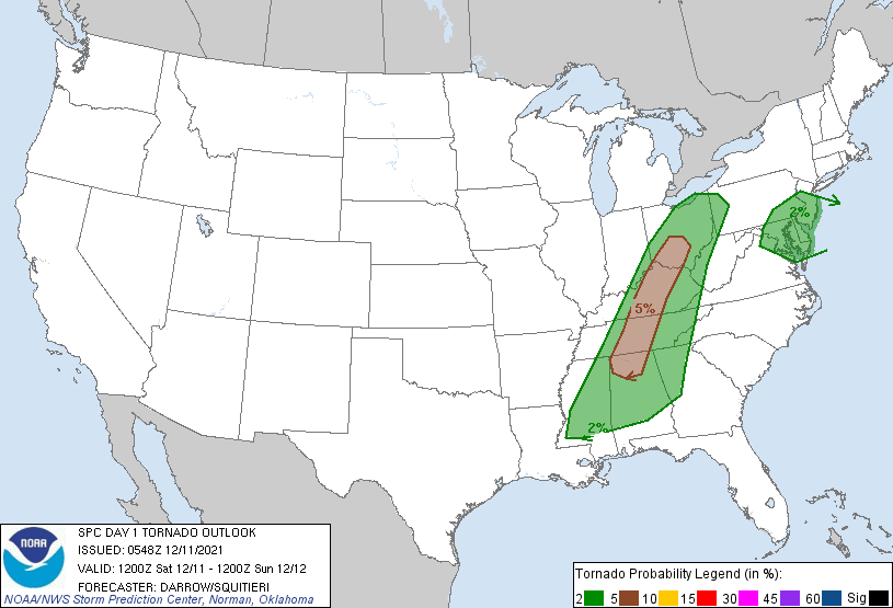
gusts and perhaps a tornado will be possible, mainly early in the
day. Isolated strong wind gusts cannot be ruled out over parts of
the Mid Atlantic during the evening.
...Ohio Valley to northern Gulf States...
Very dynamic and progressive trough is shifting across the MS Valley
late this evening. This feature will move into the Great Lakes/OH
Valley by 18z, arcing southwest into AR where mid-level flow will be
decidedly westerly and considerably weaker (50-80kt) than across the
OH Valley (120kt). 210-270m mid-level height falls will spread
across the Great Lakes into southeast Canada ahead of the trough and
this will encourage strong/severe frontal convection despite poor
lapse rates/weak buoyancy north of the OH River. Organized
convection should be ongoing at the beginning of the period along
the front from western OH-KY-middle TN-northern MS-LA. This band of
frontal convection may be severe at the beginning of the period as
low-level moisture has advanced across southern IN into southwestern
OH at 0530z where surface dew points are now in the lower 60s. NAM
forecast sounding for LUK at 13z just ahead of the front depicts
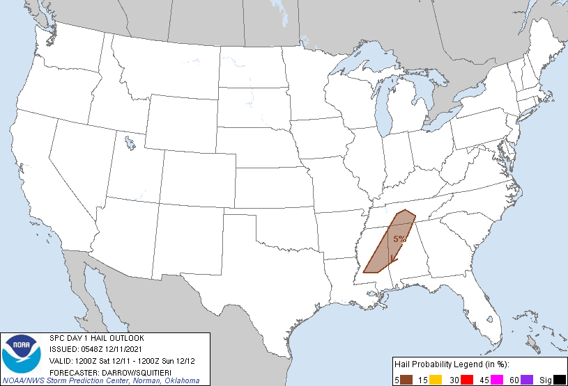
very strong shear with poor lapse rates and SBCAPE on the order of
600 J/kg. While much of this activity may be QLCS in nature, a few
supercells cannot be ruled out. Damaging winds are possible with
this early-day frontal convection along with some threat for
embedded tornadoes.
Farther south across the TN Valley into the central Gulf States,
surface heating should remain limited ahead of the trailing cold
front. Latest model guidance continues to suggest the boundary will
be convectively active at sunrise and despite poor lapse rates and
warmer mid-level temperatures, dew points have risen into the upper
60s to near 70F. Strong shear will likely maintain the frontal
squall line as it advances across the weak-buoyancy air mass.
Damaging winds and perhaps a tornado or two are the primary threats.
...Mid Atlantic...
Modified boundary-layer air mass will return across the Mid Atlantic
this morning and this will aid weak destabilization as far north as
southeast PA as mid-level profiles cool and inhibition weakens. Even
so, air mass will struggle to destabilize with forecast soundings
suggesting MUCAPE perhaps as high as 300 J/kg by early evening.
Forced line of convection may generate locally damaging winds but
this activity should remain isolated due to poor lapse rates and
weak buoyancy.
..Darrow/Squitieri.. 12/11/2021
CLICK TO GET WUUS01 PTSDY1 PRODUCT
NOTE: THE NEXT DAY 1 OUTLOOK IS SCHEDULED BY 1300Z