|
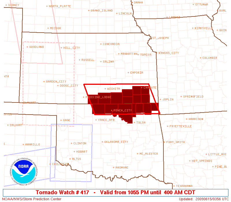
Initial List of Counties in SPC Tornado Watch 417 (WOU)
|
Back to Watch 417
|
 |
   WOUS64 KWNS 150350
   WOU7

   BULLETIN - IMMEDIATE BROADCAST REQUESTED
   TORNADO WATCH OUTLINE UPDATE FOR WT 417
   NWS STORM PREDICTION CENTER NORMAN OK
   1055 PM CDT SUN JUN 14 2009

   TORNADO WATCH 417 IS IN EFFECT UNTIL 400 AM CDT FOR THE
    FOLLOWING LOCATIONS

   KSC019-035-049-077-099-125-133-191-205-150900-
   /O.NEW.KWNS.TO.A.0417.090615T0355Z-090615T0900Z/

   KS
   .    KANSAS COUNTIES INCLUDED ARE

   CHAUTAUQUA           COWLEY              ELK
   HARPER               LABETTE             MONTGOMERY
   NEOSHO               SUMNER              WILSON


   OKC035-053-071-105-113-115-147-150900-
   /O.NEW.KWNS.TO.A.0417.090615T0355Z-090615T0900Z/

   OK
   .    OKLAHOMA COUNTIES INCLUDED ARE

   CRAIG                GRANT               KAY
   NOWATA               OSAGE               OTTAWA
   WASHINGTON


   ATTN...WFO...ICT...TSA...OUN...
|
| Aviation Watch (SAW) for WW417 |
|---|
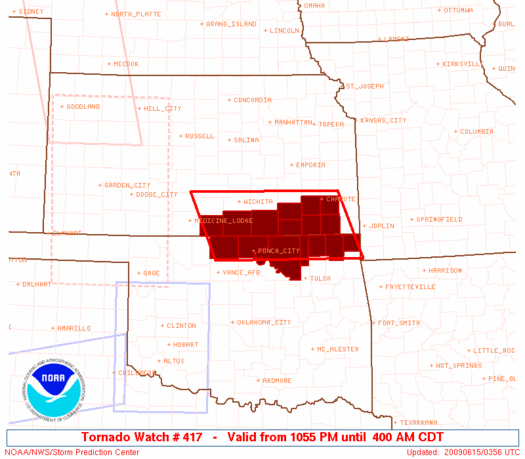 |
| Note:
The Aviation Watch (SAW) product is an approximation to the watch area.
The actual watch is depicted by the shaded areas. |
   SAW7
   WW 417 TORNADO KS OK 150355Z - 150900Z
   AXIS..95 STATUTE MILES EAST AND WEST OF LINE..
   35ENE ICT/WICHITA KS/ - 20SW BVO/BARTLESVILLE OK/
   ..AVIATION COORDS.. 80NM E/W /36E ICT - 32NW TUL/
   HAIL SURFACE AND ALOFT..2 INCHES. WIND GUSTS..60 KNOTS.
   MAX TOPS TO 500. MEAN STORM MOTION VECTOR 28035.

   LAT...LON 37839509 36549455 36549798 37839858

   THIS IS AN APPROXIMATION TO THE WATCH AREA.  FOR A
   COMPLETE DEPICTION OF THE WATCH SEE WOUS64 KWNS
   FOR WOU7.
|
|


 @NWSSPC