|
| Mesoscale Discussion 782 |
|
< Previous MD Next MD >
|
|
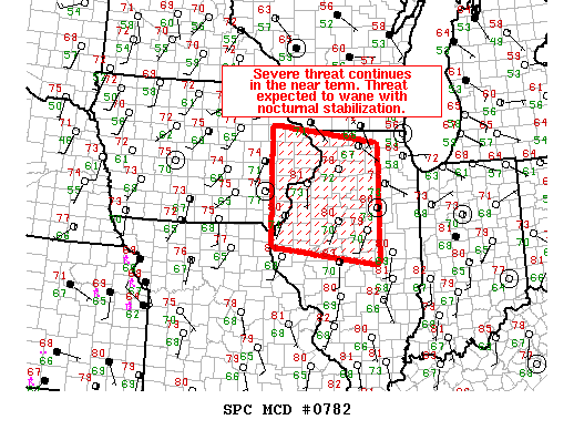
   Mesoscale Discussion 0782
   NWS Storm Prediction Center Norman OK
   0857 PM CDT Fri May 24 2019

   Areas affected...Portions of eastern Iowa...northwest and northern
   Illinois

   Concerning...Tornado Watch 236...

   Valid 250157Z - 250400Z

   The severe weather threat for Tornado Watch 236 continues.

   SUMMARY...The threat for isolated damaging wind gusts and perhaps a
   brief tornado continues with the more mature storms that are
   ongoing. Nocturnal boundary layer stabilization and increasing
   inhibition are expected to contribute to a downward trend in severe
   potential in the next few hours.

   DISCUSSION...Discrete convection continues across central and
   northern portions of Tornado Watch 0236, with a supercell structure
   noted southeast of Dubuque, Iowa, and outflow dominant storms in the
   proximity of Henry County, Illinois. With up to 2000 J/kg MLCAPE and
   over 300 m2/s2 of effective SRH established across much of Tornado
   Watch 0236, any storms that can intensify and sustain themselves may
   produce damaging wind gusts and perhaps a tornado within the next
   hour or so. Otherwise, with the general downward trend in convective
   intensity noted, increasing inhibition atop a cooling boundary layer
   is expected to dampen severe weather concerns, as supported by
   latest high resolution model guidance.

   ..Squitieri/Grams.. 05/25/2019

   ...Please see www.spc.noaa.gov for graphic product...

   ATTN...WFO...LOT...ILX...LSX...DVN...ARX...

   LAT...LON   40159145 42619145 42238862 39778862 40159145
|
|
Top/All Mesoscale Discussions/Forecast Products/Home
|
|


 @NWSSPC