|
| Mesoscale Discussion 133 |
|
< Previous MD Next MD >
|
|
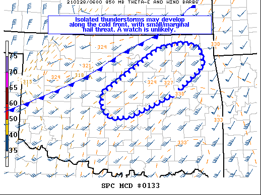
   Mesoscale Discussion 0133
   NWS Storm Prediction Center Norman OK
   0147 AM CST Sun Feb 28 2021

   Areas affected...Arkansas

   Concerning...Severe potential...Watch unlikely

   Valid 280747Z - 281015Z

   Probability of Watch Issuance...5 percent

   SUMMARY...A storm or two may briefly produce marginal hail from
   central into northeast Oklahoma.

   DISCUSSION...Surface analysis shows a cold front moving across
   northern OK, with showers now developing along it. While the
   low-level air mass is moist, drying is occurring aloft with GPS
   water-vapor values decreasing with time. Still, there may be
   sufficient boundary-layer moisture to sustain brief thunderstorms
   along the cold front over the next few hours.  The better moisture
   quality currently resides along and east of the I-44 corridor,
   beneath ample southwesterly flow aloft elongating hodographs. The
   favorable deep-layer shear as well as cold midlevel temperatures
   will conditionally favor a strong cell or two, but any threat should
   remain isolated, and likely short-lived.

   ..Jewell/Edwards.. 02/28/2021

   ...Please see www.spc.noaa.gov for graphic product...

   ATTN...WFO...TSA...OUN...

   LAT...LON   35179700 35149750 35339773 35679773 36689617 36809542
               36669502 36279495 35679576 35179700
|
|
Top/All Mesoscale Discussions/Forecast Products/Home
|
|


 @NWSSPC