|
| Mesoscale Discussion 729 |
|
< Previous MD Next MD >
|
|
Mesoscale Discussion 0729
NWS Storm Prediction Center Norman OK
0856 PM CDT Mon May 24 2021
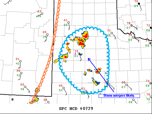
Areas affected...west Texas
Concerning...Severe Thunderstorm Watch 201...
Valid 250156Z - 250330Z
The severe weather threat for Severe Thunderstorm Watch 201
continues.
SUMMARY...Isolated damaging wind and hail remain possible through
04Z this evening over a portion of west Texas.
DISCUSSION...Storms that developed along the dryline earlier persist
across west TX generally north and west of the Lubbock area and are
moving slowly east. These storms have been poorly organized, but
tendency has been for a gradual upscale growth. Farther south, other
storms that developed in association with an MCV are moving to the
north northwest. These two clusters of storms will likely merge
within the next hour or so, and this may contribute to some
intensification. After the merger, a strengthening low-level jet may
help to maintain a forward-propagating MCS through a portion of the
warm sector before activity begins to weaken toward late evening.
..Dial.. 05/25/2021
...Please see www.spc.noaa.gov for graphic product...
ATTN...WFO...SJT...LUB...MAF...
LAT...LON 34020248 34490187 34600117 34290059 33420052 32370065
32180141 32440202 33170264 34020248
|
|
Top/All Mesoscale Discussions/Forecast Products/Home
|
|


 @NWSSPC