|
| Mesoscale Discussion 1098 |
|
< Previous MD Next MD >
|
|
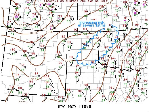
   Mesoscale Discussion 1098
   NWS Storm Prediction Center Norman OK
   0509 PM CDT Fri Jun 25 2021

   Areas affected...Texas Panhandle...northwestern
   Oklahoma...south-central Kansas

   Concerning...Severe Thunderstorm Watch 315...

   Valid 252209Z - 252345Z

   The severe weather threat for Severe Thunderstorm Watch 315
   continues.

   SUMMARY...Cluster of severe thunderstorms should spread east this
   evening. New severe thunderstorm watch may be warranted.

   DISCUSSION...Scattered strong/severe thunderstorms have evolved over
   the TX Panhandle into northwestern OK within steep low-level lapse
   rate environment. Surface dew points are also holding just ahead of
   this activity despite surface temperatures in the mid-upper 90s.
   Satellite imagery suggests storm-top evacuation is beginning to
   increase over the northeast TX Panhandle, and if clustering
   continues there is a greater propensity for this activity to
   propagate downstream into western/northern OK. Additionally, LLJ is
   expected to strengthen across the southern Plains after sunset and
   this should contribute to forward propagation as well.

   ..Darrow.. 06/25/2021

   ...Please see www.spc.noaa.gov for graphic product...

   ATTN...WFO...OUN...DDC...LUB...AMA...

   LAT...LON   35070193 37279901 36709811 35229957 34520106 35070193
|
|
Top/All Mesoscale Discussions/Forecast Products/Home
|
|


 @NWSSPC