|
| Mesoscale Discussion 1292 |
|
< Previous MD Next MD >
|
|
Mesoscale Discussion 1292
NWS Storm Prediction Center Norman OK
0214 AM CDT Thu Jul 15 2021
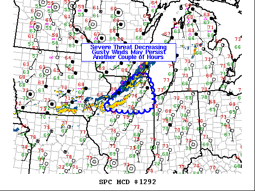
Areas affected...northern Illinois
Concerning...Severe Thunderstorm Watch 380...
Valid 150714Z - 150815Z
The severe weather threat for Severe Thunderstorm Watch 380
continues.
SUMMARY...The overall thunderstorm intensity continues to wane.
However, gusty thunderstorm winds capable of sporadic tree damage
may continue for another couple of hours.
DISCUSSION...Thunderstorm intensity continues to decrease across
northern Illinois as the nocturnal boundary layer deepens and,
consequently, low-level buoyancy weakens. Although gusty
thunderstorm winds on the leading edge of the convective line may
yield sporadic tree damage, the potential for a more organized wind
threat is diminishing.
..Marsh.. 07/15/2021
...Please see www.spc.noaa.gov for graphic product...
ATTN...WFO...LOT...ILX...MKX...DVN...
LAT...LON 41049047 42058936 42638833 42418778 41688759 41068759
40898851 40938944 41049047
|
|
Top/All Mesoscale Discussions/Forecast Products/Home
|
|


 @NWSSPC