|
| Mesoscale Discussion 776 |
|
< Previous MD Next MD >
|
|
Mesoscale Discussion 0776
NWS Storm Prediction Center Norman OK
0546 PM CDT Sun May 15 2022
Areas affected...South-central into east-central/southeast OK
Concerning...Severe Thunderstorm Watch 221...
Valid 152246Z - 160015Z
The severe weather threat for Severe Thunderstorm Watch 221
continues.
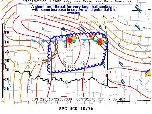
SUMMARY...Storms moving southward across east-central OK will pose a
threat for isolated very large hail through 00Z. One or more
clusters may develop with time, which would pose an increased
damaging wind risk.
DISCUSSION...Multiple discrete supercells have developed along a
southward-moving outflow boundary near the I-40 corridor of eastern
OK. The thermodynamic environment is quite favorable for hail, with
steep midlevel lapse rates and strong buoyancy noted on 18Z OUN/LZK
soundings and recent objective mesoanalyses. 2.5" diameter hail was
recently reported in Okfuskee County, and very large hail will
continue to be possible with any sustained discrete cells into the
evening. Deep-layer shear will remain sufficient for supercells, and
a tornado or two cannot be ruled out, as long as cells remain rooted
near the outflow boundary. Locally severe wind gusts will also be
possible with these supercells.
With time, additional development is possible within a growing
cumulus field to the southwest that extends into Garvin County. Some
upscale growth is possible with time due to storm mergers and
consolidating outflows, which could potentially pose an increasing
severe-wind risk as convection spreads into south-central/southeast
OK.
..Dean.. 05/15/2022
...Please see www.spc.noaa.gov for graphic product...
ATTN...WFO...SHV...TSA...OUN...
LAT...LON 35459704 35629578 35629489 35609466 35399447 34519471
34289596 34169717 35199717 35459704
|
|
Top/All Mesoscale Discussions/Forecast Products/Home
|
|


 @NWSSPC