|
| Mesoscale Discussion 796 |
|
< Previous MD Next MD >
|
|
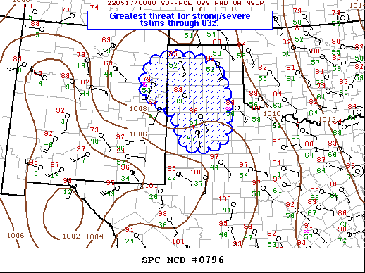
   Mesoscale Discussion 0796
   NWS Storm Prediction Center Norman OK
   0737 PM CDT Mon May 16 2022

   Areas affected...Southern High Plains

   Concerning...Severe Thunderstorm Watch 232...233...

   Valid 170037Z - 170230Z

   The severe weather threat for Severe Thunderstorm Watch 232, 233
   continues.

   SUMMARY...Thunderstorms will become more concentrated across the
   Texas Panhandle by 03z.

   DISCUSSION...Weak mid-level short-wave trough has migrated into
   eastern NM early this evening. Scattered convection continues to
   develop ahead of this feature across the southern High Plains,
   extending as far south as Gains County TX, just north of MAF. 20kt
   850mb flow currently extends across the western TX Panhandle but is
   expected to gradually increase across the TX South Plains after
   sunset. As a result, convection may continue to grow upscale as it
   encounters increasingly moist environment, aided by LLJ. This
   activity should spread toward the eastern TX Panhandle by 05z.
   Wind/hail remain possible.

   ..Darrow.. 05/17/2022

   ...Please see www.spc.noaa.gov for graphic product...

   ATTN...WFO...LUB...AMA...ABQ...

   LAT...LON   36090329 35690104 33530076 33190220 34270275 35010397
               36090329
|
|
Top/All Mesoscale Discussions/Forecast Products/Home
|
|


 @NWSSPC