|
| Mesoscale Discussion 959 |
|
< Previous MD Next MD >
|
|
Mesoscale Discussion 0959
NWS Storm Prediction Center Norman OK
0739 AM CDT Sun May 29 2022
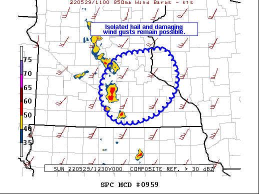
Areas affected...Central/Southern MN...West-Central WI
Concerning...Severe Thunderstorm Watch 286...
Valid 291239Z - 291415Z
The severe weather threat for Severe Thunderstorm Watch 286
continues.
SUMMARY...The threat for damaging wind gusts and hail continues
across Severe Thunderstorm Watch 286.
DISCUSSION...Showers and thunderstorms continue within the warm-air
advection regime over the Upper Midwest. Strongest updrafts within
this regime are present within the cluster moving across southern
MN. A less buoyant air mass exists downstream of this cluster, and a
gradual diminishing trends is possible over the next hour or two.
However, there is still sufficient buoyancy for storm maintenance,
with an attendant threat for damaging wind gusts and isolated large
hail.
Additional storm development is possible, particularly to the south
of the ongoing cluster mentioned above where warm-air advection is
the strongest.
..Mosier.. 05/29/2022
...Please see www.spc.noaa.gov for graphic product...
ATTN...WFO...ARX...MPX...
LAT...LON 43629374 44119433 44649426 45089382 45219298 45219231
44529200 43849263 43629374
|
|
Top/All Mesoscale Discussions/Forecast Products/Home
|
|


 @NWSSPC