|
| Mesoscale Discussion 1134 |
|
< Previous MD Next MD >
|
|
Mesoscale Discussion 1134
NWS Storm Prediction Center Norman OK
0625 PM CDT Sun Jun 12 2022
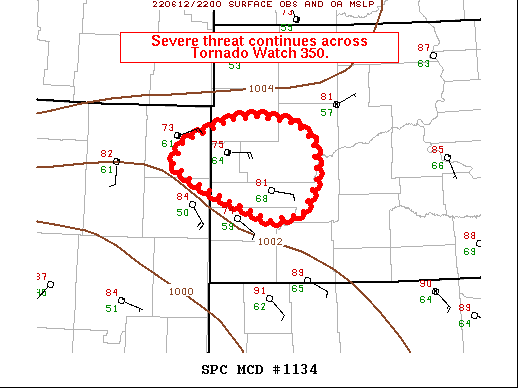
Areas affected...Parts of western SD and far northeastern WY
Concerning...Tornado Watch 350...
Valid 122325Z - 130100Z
The severe weather threat for Tornado Watch 350 continues.
SUMMARY...The severe risk will continue spreading eastward across
parts of Tornado Watch 350. Very large hail and damaging gusts are
the main concerns in the near-term, though the tornado risk could
gradually increase as well.
DISCUSSION...KUDX radar data shows an upscale-growing convective
cluster tracking east-southeastward along a surface frontal boundary
from northeastern WY into western SD. Along and south of the
boundary, dewpoints continue to increase into the upper 60s beneath
steep midlevel lapse rates -- contributing to moderate to strong
instability.
Given that storm motions and deep-layer shear is oriented largely
parallel to the surface boundary, cold pools may continue to congeal
amid the favorable buoyancy/minimal CINH. This would primarily favor
damaging gusts and sporadic large to very large hail in the
near-term. However, increasing low/midlevel warm advection atop
strengthening easterly low-level flow will result in an expanding
low-level hodograph with time, potentially favoring supercellular
modes and an increasing tornado risk.
..Weinman.. 06/12/2022
...Please see www.spc.noaa.gov for graphic product...
ATTN...WFO...UNR...
LAT...LON 43920373 44150431 44330464 44600448 44740400 44840376
44890328 44810268 44600240 44190235 43790257 43700308
43920373
|
|
Top/All Mesoscale Discussions/Forecast Products/Home
|
|


 @NWSSPC