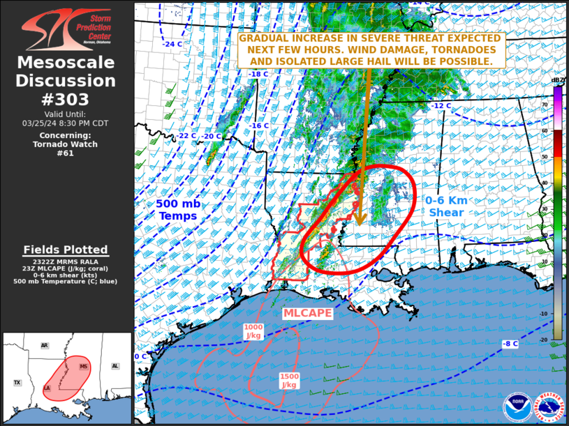
   Mesoscale Discussion 0303
   NWS Storm Prediction Center Norman OK
   0624 PM CDT Mon Mar 25 2024

   Areas affected...Eastern Louisiana...Southwest and West-central
   Mississippi

   Concerning...Tornado Watch 61...

   Valid 252324Z - 260130Z

   The severe weather threat for Tornado Watch 61 continues.

   SUMMARY...The severe threat across the lower Mississippi Valley is
   expected to gradually increase over the next few hours. Wind damage,
   tornadoes and isolated large hail will be possible. New weather
   watch issuance will likely be needed to the east of the current
   watch.

   DISCUSSION...High-resolution radar imagery from Jackson, MS and Fort
   Polk, LA currently show a line of strong thunderstorms located
   across central and northeastern Louisiana. A weakly unstable, but
   moist airmass is present ahead of the line across much of the lower
   Mississippi Valley, where surface dewpoints in the mid to upper 60s
   F. On a broader scale, water vapor imagery shows a 80 to 100 knot
   mid-level jet moving through south-central Texas. As this feature
   ejects northeastward this evening, the mass response should be
   maintained or may increase across the lower Mississippi Valley.
   This, combined with strong deep-layer shear will likely create an
   environment supportive of severe storms. Recent trends suggest that
   the line has become somewhat more organized over the last hour. The
   threat for wind damage, tornadoes and isolated large hail will be
   possible, especially with cells that are more likely surface-based
   to the east of the ongoing line.

   ..Broyles.. 03/25/2024

   ...Please see www.spc.noaa.gov for graphic product...

   ATTN...WFO...JAN...LIX...LCH...SHV...

   LAT...LON   31759222 31179274 30679278 30299222 30289120 30639041
               31248983 31998925 32688918 33068950 33198993 33209053
               32989109 32249183 31759222
|


 @NWSSPC