|
| Mesoscale Discussion 325 |
|
< Previous MD Next MD >
|
|
Mesoscale Discussion 0325
NWS Storm Prediction Center Norman OK
0350 PM CDT Mon Apr 01 2024
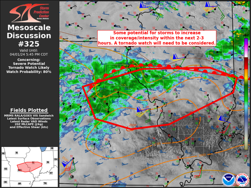
Areas affected...Portions of central/eastern Missouri into parts of
central Illinois
Concerning...Severe potential...Tornado Watch likely
Valid 012050Z - 012245Z
Probability of Watch Issuance...80 percent
SUMMARY...A tornado watch may be needed within the next 1-2 hours as
additional storms may develop in east-central Missouri/central
Illinois. The environment is supportive of large/very-large hail and
damaging winds. The tornado threat is expected to increase this
evening as low-level shear increases near the boundary.
DISCUSSION...Cores within a broad area of precipitation have
occasionally pulsed in intensity. Some recent CAM guidance suggest
that additional storms will develop out of this activity within the
next 2-3 hours. While current wind profiles are not overly
supportive of tornadoes, storms will be near the warm front and
low-level shear should improve this evening as 850 mb winds
increase. Given the background environment and potential evolution
of this activity, a tornado watch will need to be considered.
..Wendt/Thompson.. 04/01/2024
...Please see www.spc.noaa.gov for graphic product...
ATTN...WFO...IND...ILX...LSX...SGF...EAX...
LAT...LON 39299311 39839092 39848842 39538742 39128758 38238994
38109132 38389261 39299311
|
|
Top/All Mesoscale Discussions/Forecast Products/Home
|
|


 @NWSSPC