Probability of a tornado within 25 miles of a point. Hatched Area: 10% or greater probability of EF2 - EF5 tornadoes within 25 miles of a point.
Day 1 Tornado Risk
Area (sq. mi.)
Area Pop.
Some Larger Population Centers in Risk Area
No Risk Areas Forecast
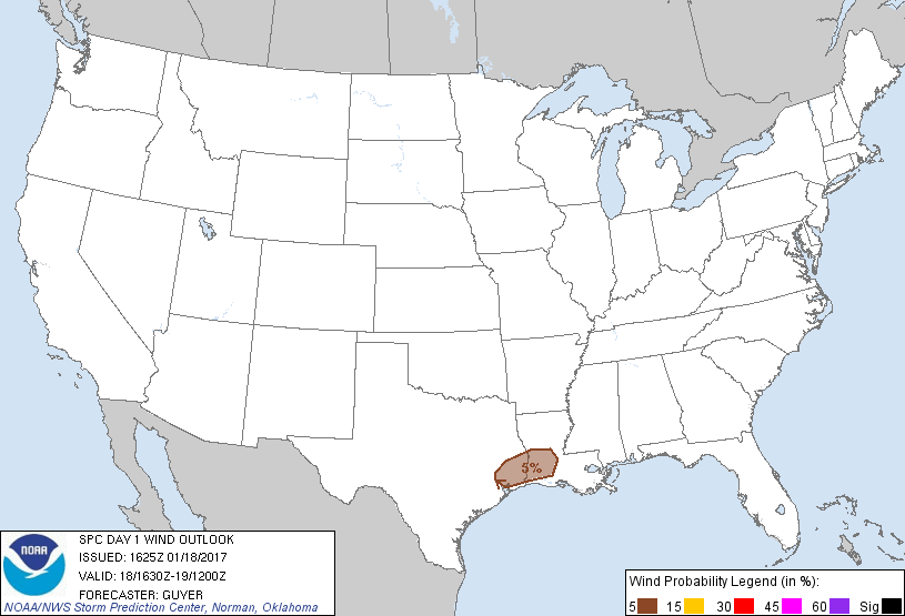
Probabilistic Damaging Wind Graphic
Probability of damaging thunderstorm winds or wind gusts of 50 knots or higher within 25 miles of a point. Hatched Area: 10% of greater probability of wind gusts 65 knots or greater within 25 miles of a point.
Probability of hail 1" or larger within 25 miles of a point. Hatched Area: 10% or greater probability of hail 2" or larger within 25 miles of a point.
Day 1 Hail Risk
Area (sq. mi.)
Area Pop.
Some Larger Population Centers in Risk Area
No Risk Areas Forecast
SPC AC 181625
Day 1 Convective Outlook
NWS Storm Prediction Center Norman OK
1025 AM CST Wed Jan 18 2017
Valid 181630Z - 191200Z
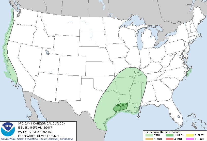
...THERE IS A MARGINAL RISK OF SEVERE THUNDERSTORMS ACROSS PARTS OF
SOUTHEAST TEXAS AND SOUTHERN LOUISIANA...
...SUMMARY...
A few strong/locally severe storms could occur this afternoon and/or
tonight across parts of southeast Texas into southern Louisiana.
...Southern Louisiana/southeast Texas...
Ongoing scattered showers and a few embedded thunderstorms across
the region continue to reinforce a southwest/northeast-oriented
front from near-coastal TX into south-central LA. While a moist air
mass resides near/south of the front (70s F surface dewpoints),
mid-level lapse rates are weak per 12Z observed soundings and
background forcing for ascent will also remain weak diurnally ahead
of an upper trough, which is currently centered over CO/NM and the
adjacent southern High Plains.
While overall buoyancy will remain relatively modest and effective
shear will be semi-weak through the afternoon (30-35 kt), a couple
of stronger storms could occur near the effective boundary presuming
some thinning of persistent cloud cover. Later this evening into the
overnight, forcing for ascent/vertical shear will gradually increase
in response to the amplifying trough over the southern Plains.
Somewhat more favorable shear profiles could conditionally support
some organized storms/transient supercells, although weak lapse
rates/buoyancy should keep any severe risk localized late tonight.
..Guyer/Leitman.. 01/18/2017
CLICK TO GET WUUS01 PTSDY1 PRODUCT
NOTE: THE NEXT DAY 1 OUTLOOK IS SCHEDULED BY 2000Z