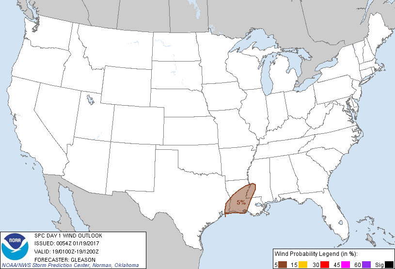
Probability of damaging thunderstorm winds or wind gusts of 50 knots or higher within 25 miles of a point. Hatched Area: 10% of greater probability of wind gusts 65 knots or greater within 25 miles of a point.
Probability of hail 1" or larger within 25 miles of a point. Hatched Area: 10% or greater probability of hail 2" or larger within 25 miles of a point.
Day 1 Hail Risk
Area (sq. mi.)
Area Pop.
Some Larger Population Centers in Risk Area
No Risk Areas Forecast
SPC AC 190054
Day 1 Convective Outlook
NWS Storm Prediction Center Norman OK
0654 PM CST Wed Jan 18 2017
Valid 190100Z - 191200Z
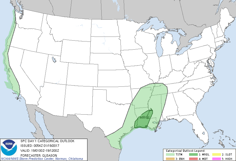
...THERE IS A MARGINAL RISK OF SEVERE THUNDERSTORMS ACROSS PARTS OF
SOUTHEAST TX...SOUTHERN/CENTRAL LA...AND SOUTHWEST MS...
...SUMMARY...
A few strong to severe storms could occur through tonight across
parts of southeast Texas into southern/central Louisiana and
southwest Mississippi. Isolated strong to locally damaging wind
gusts and perhaps a brief tornado are the main threats.
...Southeast TX into Southern/Central LA and Southwest MS...
Water-vapor satellite imagery depicts a closed mid/upper-level low
over the southern and central High Plains this evening. This low
should move only slowly eastward over the Plains through early
Thursday morning. A belt of southwesterly mid-level winds generally
around 40-60 kt associated with the mid/upper-level low will
likewise spread eastward across TX into the lower MS Valley through
12Z Thursday. At the surface, a weak low was located near the TX/LA
border as of 00Z, with a nearly stationary front extending
east/northeastward from this low across central LA into central MS.
A cold front extends southward from the TX/LA low into the western
Gulf of Mexico. The quasi-stationary front should lift northward as
a warm front across parts of the lower MS Valley towards the
Mid-South through Thursday morning.
The airmass along and south of the quasi-stationary front across
southeast TX into southern/central LA and southwest MS will probably
remain weakly unstable through the overnight hours, as surface
dewpoints range from the mid 60s to lower 70s. Low-level flow is not
expected to be overly strong through the remainder of the evening,
but some increase in surface to 850-mb flow may occur late (09-12Z)
as a southwesterly low-level jet strengthens across this region.
Convective coverage may also increase late in the period as
low-level warm air advection strengthens, as indicated by multiple
recent convection-allowing model solutions.
The 00Z sounding from LCH along with NAM/RAP forecast soundings
across the warm sector suggest a sufficient, albeit marginal,
combination of instability and low- to mid-level shear will exist
for the remainder of the Day 1 period to support an isolated strong
to locally damaging wind gust with any thunderstorms that can be
surface-based. In addition, effective SRH around 100-125 m2/s2
(locally higher near the quasi-stationary/warm front), may be enough
for a brief tornado with any sustained updraft. Poor low- to
mid-level lapse rates and resulting weak instability are expected to
limit a greater severe-weather risk.
..Gleason.. 01/19/2017
CLICK TO GET WUUS01 PTSDY1 PRODUCT
NOTE: THE NEXT DAY 1 OUTLOOK IS SCHEDULED BY 0600Z