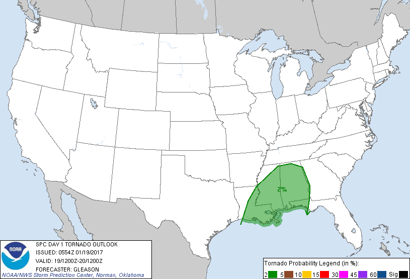
New Orleans, LA...Birmingham, AL...Baton Rouge, LA...Montgomery, AL...Mobile, AL...
Probabilistic Tornado Graphic
Probability of a tornado within 25 miles of a point. Hatched Area: 10% or greater probability of EF2 - EF5 tornadoes within 25 miles of a point.
Day 1 Tornado Risk
Area (sq. mi.)
Area Pop.
Some Larger Population Centers in Risk Area
2 %
130,940
11,521,394
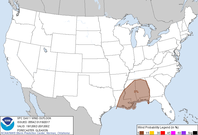
New Orleans, LA...Birmingham, AL...Baton Rouge, LA...Montgomery, AL...Mobile, AL...
Probabilistic Damaging Wind Graphic
Probability of damaging thunderstorm winds or wind gusts of 50 knots or higher within 25 miles of a point. Hatched Area: 10% of greater probability of wind gusts 65 knots or greater within 25 miles of a point.
Day 1 Wind Risk
Area (sq. mi.)
Area Pop.
Some Larger Population Centers in Risk Area
5 %
130,945
11,513,668
New Orleans, LA...Birmingham, AL...Baton Rouge, LA...Montgomery, AL...Mobile, AL...
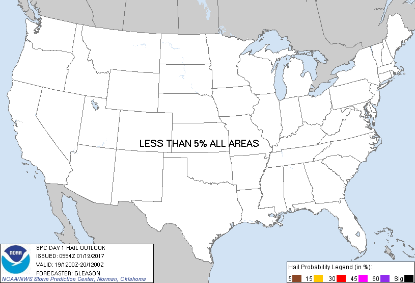
Probabilistic Large Hail Graphic
Probability of hail 1" or larger within 25 miles of a point. Hatched Area: 10% or greater probability of hail 2" or larger within 25 miles of a point.
Day 1 Hail Risk
Area (sq. mi.)
Area Pop.
Some Larger Population Centers in Risk Area
No Risk Areas Forecast
   SPC AC 190554

   Day 1 Convective Outlook
   NWS Storm Prediction Center Norman OK
   1154 PM CST Wed Jan 18 2017

   Valid 191200Z - 201200Z

   ...THERE IS A MARGINAL RISK OF SEVERE THUNDERSTORMS ACROSS PORTIONS
   OF THE LOWER MISSISSIPPI VALLEY AND CENTRAL GULF COASTAL REGION...

   ...SUMMARY...
   A marginal severe threat, with isolated strong to locally damaging
   winds and perhaps a tornado, will be possible across parts of the
   lower Mississippi Valley and central Gulf Coast states on Thursday.

   ...Synopsis...
   An upper trough/low centered over the central Plains Thursday
   morning will move slowly northeastward to the upper Midwest as an
   embedded shortwave trough moves from TX to the lower MS Valley
   through the day. A low-level jet is forecast to strengthen across
   the lower MS Valley by 12Z Thursday, and showers and thunderstorms
   should be ongoing across LA/MS in association with low-level warm
   air advection and ascent at the beginning of the period. A weak
   surface low over the Mid-South should develop northward to the mid
   MS Valley/lower OH Valley by Thursday evening as a trailing cold
   front becomes increasingly ill-defined across the lower MS Valley. A
   warm front will lift slowly northward across the TN Valley/Mid-South
   in conjunction with the surface low, and a moist low-level airmass
   characterized by low 60s to low 70s surface dewpoints will be in
   place across much of the lower MS Valley into the central Gulf Coast
   region. A shortwave trough will move across southern CA Thursday
   morning, as a large-scale trough develops eastward over the western
   CONUS.

   ...Lower MS Valley and Central Gulf Coast Region...
   The effect of early-day precipitation and clouds across LA/MS will
   likely serve to limit substantial diurnal heating downstream across
   the central Gulf Coast region through the afternoon. 00Z soundings
   from LCH, SHV, and JAN all show the presence of poor low- to
   mid-level lapse rates (generally 5.5-6.0 degrees C/km), and the
   prospect for steepening of these lapse rates appears very low given
   the sub-tropical origin of the upstream airmass. NAM/RAP forecast
   soundings suggest that even with modest diurnal heating, MLCAPE
   should struggle to exceed 500 J/kg on a widespread basis across the
   warm sector Thursday afternoon.

   A gradual intensification of early morning convection as it moves
   eastward across LA/MS/AL and the FL Panhandle/far western GA appears
   to be the most probable convective scenario for Thursday
   afternoon/evening. Effective bulk shear values on the order of 35-45
   kt and modestly enlarged low-level hodographs will generally support
   rotating updrafts with this activity even though instability will
   likely remain weak. Primary severe threats should be isolated strong
   to locally damaging winds as convection attempts to form into short
   line segments, and perhaps a brief embedded tornado or two.

   A more organized line of thunderstorms may develop from the
   early-day convection, but this does not appear overly likely at this
   time given the limited thermodynamic environment. Additionally, the
   cold front is forecast to weaken through the day, and flow aloft
   should remain largely parallel to the front and forecast morning
   convection. The marginal severe threat should slowly diminish
   through the evening across AL, far western GA, and the FL Panhandle
   with the loss of daytime heating and related instability.

   ...Coastal Southern CA...
   A line of low-topped thunderstorms associated with a shortwave
   trough may be approaching the southern CA Coast at 12Z Thursday.
   While isolated lightning strikes may occur with this activity,
   forecast instability and low-level flow both appear too weak to
   support the introduction of low wind probabilities.

   ..Gleason/Picca.. 01/19/2017

   CLICK TO GET WUUS01 PTSDY1 PRODUCT

   NOTE: THE NEXT DAY 1 OUTLOOK IS SCHEDULED BY 1300Z