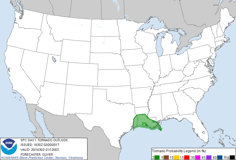
New Orleans, LA...Baton Rouge, LA...Metairie, LA...Lafayette, LA...Beaumont, TX...
Probabilistic Tornado Graphic
Probability of a tornado within 25 miles of a point. Hatched Area: 10% or greater probability of EF2 - EF5 tornadoes within 25 miles of a point.
Day 1 Tornado Risk
Area (sq. mi.)
Area Pop.
Some Larger Population Centers in Risk Area
2 %
37,693
3,703,559
New Orleans, LA...Baton Rouge, LA...Metairie, LA...Lafayette, LA...Beaumont, TX...
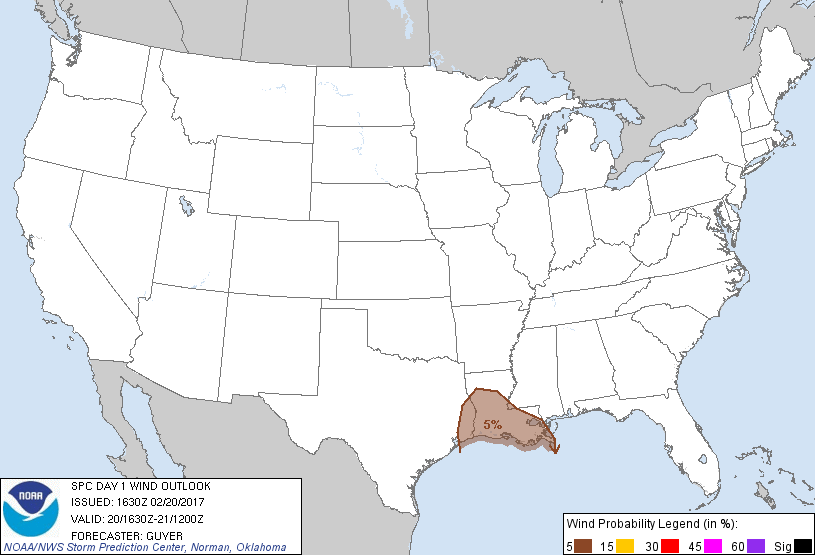
Probabilistic Damaging Wind Graphic
Probability of damaging thunderstorm winds or wind gusts of 50 knots or higher within 25 miles of a point. Hatched Area: 10% of greater probability of wind gusts 65 knots or greater within 25 miles of a point.
Day 1 Wind Risk
Area (sq. mi.)
Area Pop.
Some Larger Population Centers in Risk Area
5 %
43,969
4,090,031
New Orleans, LA...Baton Rouge, LA...Metairie, LA...Lafayette, LA...Beaumont, TX...
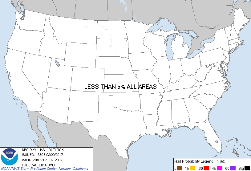
Probabilistic Large Hail Graphic
Probability of hail 1" or larger within 25 miles of a point. Hatched Area: 10% or greater probability of hail 2" or larger within 25 miles of a point.
Day 1 Hail Risk
Area (sq. mi.)
Area Pop.
Some Larger Population Centers in Risk Area
No Risk Areas Forecast
SPC AC 201630
Day 1 Convective Outlook
NWS Storm Prediction Center Norman OK
1030 AM CST Mon Feb 20 2017
Valid 201630Z - 211200Z
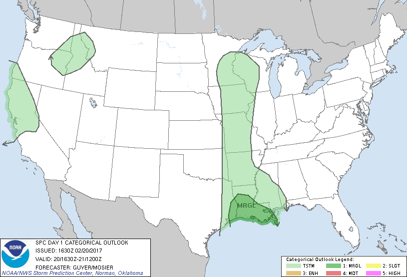
...THERE IS A MARGINAL RISK OF SEVERE THUNDERSTORMS ACROSS THE
WESTERN/CENTRAL GULF COAST REGION...
...SUMMARY...
Thunderstorms will move across parts of the upper Texas coastal
plain and Louisiana through tonight. Sporadic, isolated damaging
gusts and/or a brief tornado are possible.
...Southeast Texas to Louisiana...
A north/south-oriented band of composite-outflow-related convection
will continue to slowly progress eastward across far southeast Texas
into Louisiana through the afternoon and evening. While
line-preceding cloud cover remains semi-thick late this morning,
some pockets of stronger heating may occur ahead of the line this
afternoon and allow for at least a modest intensification of storms
along and immediately ahead of the line. Furthermore, low-level
winds may modestly strengthen by early evening as these storms shift
eastward across Louisiana. These factors suggest that a few storms
could produce locally damaging winds and/or a brief tornado this
afternoon into tonight, but the overall risk is currently expected
to remain relatively marginal and isolated in nature.
...Coastal northern California...
A modestly amplifying shortwave trough and strong mid/high-level jet
will continue to approach northern California through this evening.
Although temperatures will be cool and buoyancy will be very weak
over inland areas, steepening lapse rates in the presence of strong
deep-layer southwesterly winds could allow a few stronger storms to
approach coastal northern California this evening or early in the
overnight.
..Guyer/Mosier.. 02/20/2017
CLICK TO GET WUUS01 PTSDY1 PRODUCT
NOTE: THE NEXT DAY 1 OUTLOOK IS SCHEDULED BY 2000Z