Probability of a tornado within 25 miles of a point. Hatched Area: 10% or greater probability of EF2 - EF5 tornadoes within 25 miles of a point.
Day 1 Tornado Risk
Area (sq. mi.)
Area Pop.
Some Larger Population Centers in Risk Area
No Risk Areas Forecast
Probabilistic Damaging Wind Graphic
Probability of damaging thunderstorm winds or wind gusts of 50 knots or higher within 25 miles of a point. Hatched Area: 10% of greater probability of wind gusts 65 knots or greater within 25 miles of a point.
SPC AC 110524
Day 1 Convective Outlook
NWS Storm Prediction Center Norman OK
1124 PM CST Fri Mar 10 2017
Valid 111200Z - 121200Z
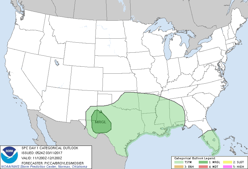
...THERE IS A MARGINAL RISK OF SEVERE THUNDERSTORMS ACROSS THE
PERMIAN BASIN AND VICINITY...
...SUMMARY...
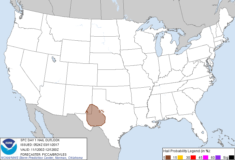
A few thunderstorms may produce marginally severe hail and
occasional gusty winds across southeast New Mexico and west Texas
Saturday evening into the early overnight hours.
...Synopsis...
Cyclonic mid-level flow will persist across much of the US east of
the Rockies today, as a closed low at its center slowly migrates
east across the Canadian Maritimes. Along the southwestern periphery
of the larger-scale trough, multiple embedded impulses (currently
noted in water-vapor imagery across the northern Rockies and
Inter-Mountain West) will advance southeast across the central US.
In the wake of these impulses, surface high pressure will build over
much of the Plains states, forcing a cold front to push south across
the southern high Plains.
...Permian Basin and vicinity...
As the aforementioned surface front moves south across parts of west
Texas and southeastern New Mexico late in the day, it will encounter
dew points in the 40s to near 50. While these will have decreased
through the day in response to deep mixing, steep mid-level lapse
rates will contribute to approximately 500-1000 J/kg of MLCAPE. By
early evening, a few thunderstorms should organize along the front
and propagate southward. Relatively weak tropospheric flow will
likely favor multicellular structures, but a veering profile with
height may yield enough updraft organization for marginally severe
hail production. Also, cells forming off higher terrain to the west
may eventually merge with this frontal convection, offering the
potential for very modest upscale growth and resultant gusty winds.
Over time through the evening and overnight, the front will have a
tendency to undercut new updrafts, reducing any remaining severe
threat.
..Picca/Broyles/Mosier.. 03/11/2017
CLICK TO GET WUUS01 PTSDY1 PRODUCT
NOTE: THE NEXT DAY 1 OUTLOOK IS SCHEDULED BY 1300Z