Omaha, NE...Lincoln, NE...Salt Lake City, UT...West Valley City, UT...Provo, UT...
Probabilistic Tornado Graphic
Probability of a tornado within 25 miles of a point. Hatched Area: 10% or greater probability of EF2 - EF5 tornadoes within 25 miles of a point.
Day 1 Tornado Risk
Area (sq. mi.)
Area Pop.
Some Larger Population Centers in Risk Area
No Risk Areas Forecast
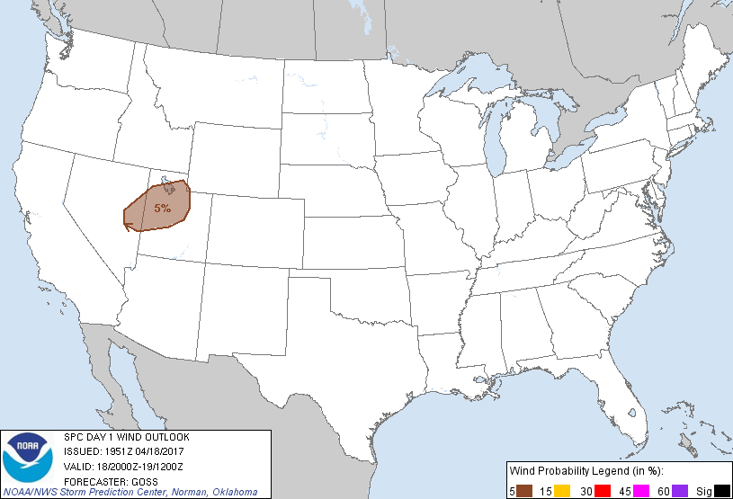
Probabilistic Damaging Wind Graphic
Probability of damaging thunderstorm winds or wind gusts of 50 knots or higher within 25 miles of a point. Hatched Area: 10% of greater probability of wind gusts 65 knots or greater within 25 miles of a point.
Day 1 Wind Risk
Area (sq. mi.)
Area Pop.
Some Larger Population Centers in Risk Area
5 %
37,611
2,292,689
Salt Lake City, UT...West Valley City, UT...Provo, UT...West Jordan, UT...Orem, UT...
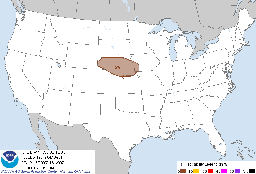
Probabilistic Large Hail Graphic
Probability of hail 1" or larger within 25 miles of a point. Hatched Area: 10% or greater probability of hail 2" or larger within 25 miles of a point.
Day 1 Hail Risk
Area (sq. mi.)
Area Pop.
Some Larger Population Centers in Risk Area
5 %
76,869
1,991,617
Omaha, NE...Lincoln, NE...Council Bluffs, IA...Bellevue, NE...Grand Island, NE...
SPC AC 181951
Day 1 Convective Outlook
NWS Storm Prediction Center Norman OK
0251 PM CDT Tue Apr 18 2017
Valid 182000Z - 191200Z
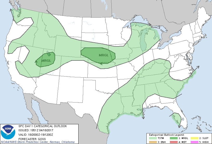
...THERE IS A MARGINAL RISK OF SEVERE THUNDERSTORMS ACROSS MUCH OF
NEBRASKA AND VICINITY...
...THERE IS A MARGINAL RISK OF SEVERE THUNDERSTORMS ACROSS A PORTION
OF EAST-CENTRAL NEVADA INTO NORTHERN AND CENTRAL UTAH...
...SUMMARY...
Isolated strong/damaging gusts will be possible this
afternoon/evening from eastern Nevada into central/northern Utah.
Overnight, isolated large hail will be possible across parts of
Nebraska and vicinity.
...Discussion...
With prior forecast reasoning/areas still representing the expected
evolution of convective weather today and tonight, no appreciable
changes are required to the outlook at this time.
..Goss.. 04/18/2017
.PREV DISCUSSION... /ISSUED 1115 AM CDT Tue Apr 18 2017/
...Eastern NV into central/northern UT this afternoon/evening...
A mid-upper speed max now approaching central CA will move over
NV/UT by this evening. An associated surface cold front will cross
eastern NV and UT this afternoon/evening, providing a focus for
thunderstorm development. Though buoyancy will be weak, ascent
along the front will support a band of convection in an environment
of strong deep-layer vertical shear and steep low-level lapse rates.
The stronger storms in the band could produce isolated
strong/damaging outflow gusts.
...NE area tonight...
In the wake of shortwave trough crossing MN this morning, a
baroclinic zone will stall near the KS/NE border as lee cyclogenesis
begins this afternoon across eastern CO. The boundary layer will
likely remain capped along the front through the afternoon.
Tonight, residual boundary-layer moisture (55-60 F dewpoints) along
and south of the front will contribute to destabilization above the
surface in a strengthening warm-advection regime, as a shortwave
trough approaches the High Plains. Elevated thunderstorm
development tonight, in an environment with MUCAPE near 1000 J/kg
(rooted in the 850-700 mb layer), will pose a risk for isolated
large hail.
CLICK TO GET WUUS01 PTSDY1 PRODUCT
NOTE: THE NEXT DAY 1 OUTLOOK IS SCHEDULED BY 0100Z