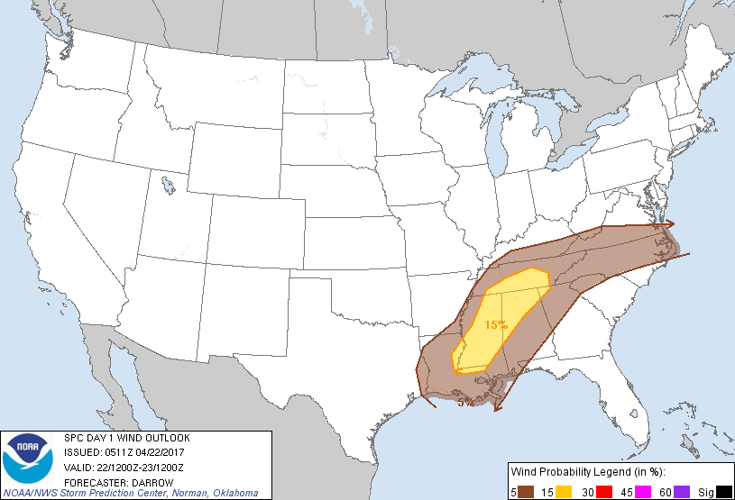
Probability of damaging thunderstorm winds or wind gusts of 50 knots or higher within 25 miles of a point. Hatched Area: 10% of greater probability of wind gusts 65 knots or greater within 25 miles of a point.
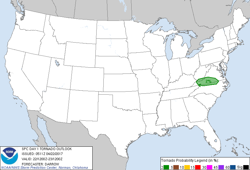
Memphis, TN...Charlotte, NC...Nashville, TN...New Orleans, LA...Virginia Beach, VA...
SPC AC 220511
Day 1 Convective Outlook
NWS Storm Prediction Center Norman OK
1211 AM CDT Sat Apr 22 2017
Valid 221200Z - 231200Z
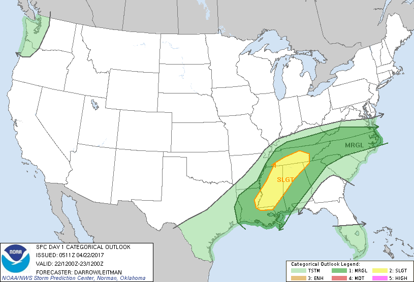
...THERE IS A SLIGHT RISK OF SEVERE THUNDERSTORMS ACROSS THE
MID-SOUTH...
...THERE IS A MARGINAL RISK OF SEVERE THUNDERSTORMS FROM THE LOWER
MISSISSIPPI VALLEY TO THE MIDDLE ATLANTIC COAST....
...SUMMARY...
Scattered thunderstorms will be noted along a corridor from portions
of the Lower Mississippi Valley to the Middle Atlantic Saturday.
Gusty winds and hail may accompany some of this activity, especially
over Mississippi into southern Tennessee.
...Discussion...
Short-range model guidance continues to suggest 500mb speed max will
sag southeast across the Arklatex region late in the period which
should encourage upper trough to dig across the Mid-South by the end
of the period. Large-scale forcing for ascent should focus along
the cool side of a slow-moving front from AR to the central
Appalachians and convection should be most concentrated along this
corridor.
Latest thinking is remnant MCS from late Friday convection will
extend from near the AR/LA border...northeast into the TN Valley at
daybreak Saturday. Early-day storms should force the surface front
into LA early in the period and the effective wind shift will likely
be shunted to near the MS border by 18z. Boundary-layer heating is
expected to aid destabilization across the warm sector and renewed
frontal convection should develop as readings warm into the upper
70s to near 80. Forecast soundings do not exhibit particularly
steep lapse rates but deep-layer shear is expected to support
organized clusters/line segments capable of producing gusty
winds/hail with the strongest activity.
Downstream across the Middle Atlantic...weak short-wave ridging is
expected to develop by early afternoon in the wake of ejecting speed
max. This mid-level feature should allow surface front to sag
toward the VA/NC border during the afternoon where it will likely
serve as the focus for convective initiation. Forecast soundings
suggest strong heating will be observed east of the higher terrain,
south of the front, and convective temperatures should be breached
within an otherwise weakly forced environment. Even so, shear
profiles will likely support organized updrafts and a few supercells
could evolve near the frontal zone. Isolated hail/wind are the
primary risks.
..Darrow/Leitman.. 04/22/2017
CLICK TO GET WUUS01 PTSDY1 PRODUCT
NOTE: THE NEXT DAY 1 OUTLOOK IS SCHEDULED BY 1300Z