Probability of a tornado within 25 miles of a point. Hatched Area: 10% or greater probability of EF2 - EF5 tornadoes within 25 miles of a point.
Day 1 Tornado Risk
Area (sq. mi.)
Area Pop.
Some Larger Population Centers in Risk Area
No Risk Areas Forecast
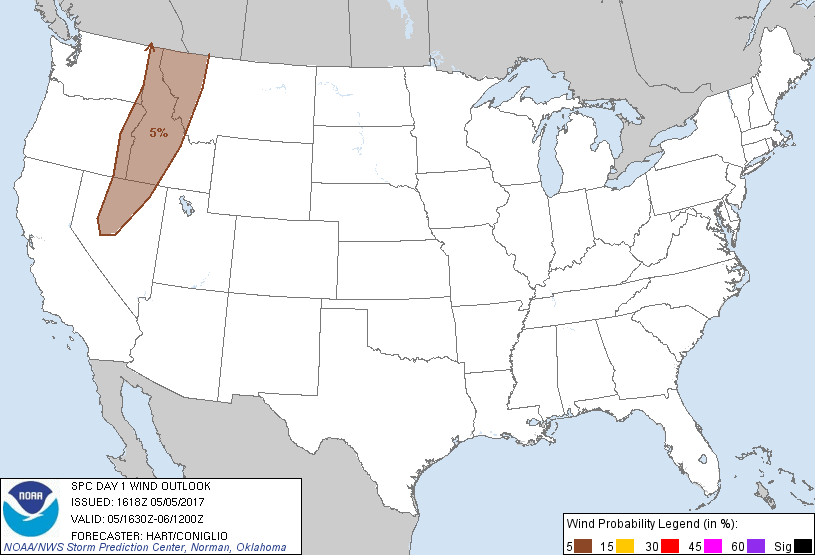
Probabilistic Damaging Wind Graphic
Probability of damaging thunderstorm winds or wind gusts of 50 knots or higher within 25 miles of a point. Hatched Area: 10% of greater probability of wind gusts 65 knots or greater within 25 miles of a point.
Day 1 Wind Risk
Area (sq. mi.)
Area Pop.
Some Larger Population Centers in Risk Area
5 %
123,597
1,563,628
Nampa, ID...Missoula, MT...Meridian, ID...Twin Falls, ID...Caldwell, ID...
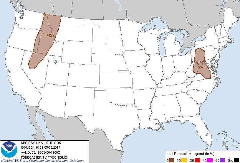
Probabilistic Large Hail Graphic
Probability of hail 1" or larger within 25 miles of a point. Hatched Area: 10% or greater probability of hail 2" or larger within 25 miles of a point.
SPC AC 051618
Day 1 Convective Outlook
NWS Storm Prediction Center Norman OK
1118 AM CDT Fri May 05 2017
Valid 051630Z - 061200Z
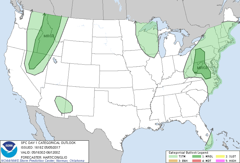
...THERE IS A MARGINAL RISK OF SEVERE THUNDERSTORMS OVER PORTIONS OF
THE NORTHERN GREAT BASIN AND NORTHERN ROCKIES...
...THERE IS A MARGINAL RISK OF SEVERE THUNDERSTORMS ACROSS PARTS OF
THE CENTRAL APPALACHIANS AND MID-ATLANTIC REGIONS...
...SUMMARY...
Isolated strong/severe storms producing hail are possible this
afternoon/evening over parts of the Mid-Atlantic states and central
Appalachians. Elsewhere, isolated strong to briefly severe storms
will be possible through the evening across portions of the northern
Great Basin and northern Rockies.
...Mid-Atlantic and central Appalachian states...
The strong squall line that affected the Carolinas and Delmarva
region this morning has moved offshore, with the associated severe
threat ending. In the wake of this system, clearing skies over
parts of PA/MD/WV/VA will help to destabilize the region and help to
initiate scattered afternoon showers and thunderstorms. Most 12z
model solutions suggest that the corridor of most likely development
is from central WV into western PA, with other more isolated
convection extending southward across central MD/VA. Forecast
soundings in this area show steep mid level lapses rates and cold
temperatures aloft, which would be favorable for hail in the
stronger cells. This threat should diminish rapidly after sunset.
...MT/ID into NV...
A large upper trough is moving into the Pacific Northwest states
today, with a band of sufficient low/mid level moisture for deep
convection extending from western MT/ID into NV. Rather strong
heating will occur this morning and early afternoon, resulting in at
least marginal CAPE values and the risk of scattered thunderstorms.
A consensus of 12z CAM solutions suggests the most likely corridor
of afternoon thunderstorms will be across far northern NV into
southwest ID. Thunderstorm activity will likely be more isolated
across the remainder of the MRGL risk area. The stronger cores over
this entire region will pose a risk of hail and gusty winds.
..Hart/Coniglio.. 05/05/2017
CLICK TO GET WUUS01 PTSDY1 PRODUCT
NOTE: THE NEXT DAY 1 OUTLOOK IS SCHEDULED BY 2000Z