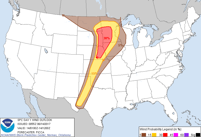
Probability of damaging thunderstorm winds or wind gusts of 50 knots or higher within 25 miles of a point. Hatched Area: 10% of greater probability of wind gusts 65 knots or greater within 25 miles of a point.
Day 1 Wind Risk
Area (sq. mi.)
Area Pop.
Some Larger Population Centers in Risk Area
30 %
69,618
2,211,033
Sioux Falls, SD...Sioux City, IA...St. Cloud, MN...Mankato, MN...Fremont, NE...
SPC AC 140055
Day 1 Convective Outlook
NWS Storm Prediction Center Norman OK
0755 PM CDT Tue Jun 13 2017
Valid 140100Z - 141200Z
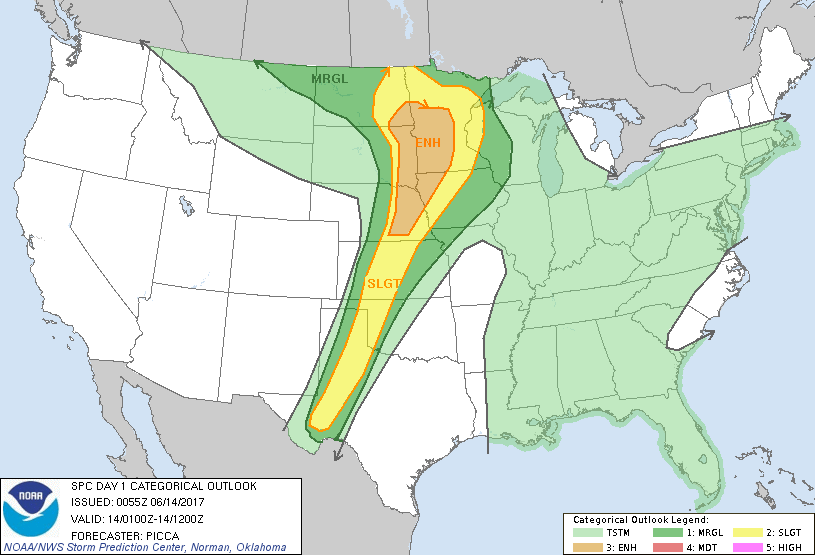
...THERE IS AN ENHANCED RISK OF SEVERE THUNDERSTORMS ACROSS THE MID
MISSOURI VALLEY AND UPPER MISSISSIPPI VALLEY...
...THERE IS A SLIGHT RISK OF SEVERE THUNDERSTORMS ACROSS PORTIONS OF
THE PLAINS STATES...
...THERE IS A MARGINAL RISK OF SEVERE THUNDERSTORMS SURROUNDING THE
SLIGHT RISK ACROSS THE CENTRAL US...
...SUMMARY...
Severe thunderstorms will continue east across the upper Mississippi
Valley this evening, with an attendant threat of damaging winds,
large hail, and a few tornadoes. These storms will progress east
across Minnesota overnight, with the threat transitioning to mainly
damaging winds. Isolated/widely scattered severe storms, capable of
large hail and damaging winds, will remain possible this evening
over the southern/central Plains, as well.
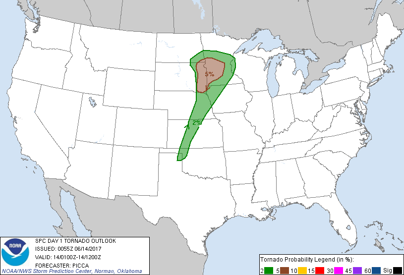
...Upper Midwest...
With the steady approach of the western U.S. trough, numerous severe
thunderstorms continue to evolve across the region at present. Two
regimes of severe thunderstorms have emerged: 1) An evolving QLCS
approaching the South Dakota/Minnesota border and 2) a cluster of
storms with embedded mesocyclones over west-central Minnesota. The
first area will likely continue to accelerate eastward, pushing into
a moist/unstable environment over southern/central Minnesota this
evening. The main threat with this activity will likely be damaging
winds, with some potential for a couple tornadoes closer to the warm
front, where storm-relative helicity is maximized. Amplifying
warm-air advection associated with a strengthening low-level jet is
fostering the second area of convection farther east along the front
(over west-central Minnesota). Rich boundary-layer moisture and
backed low-level flow will maintain an environment supporting a
couple tornadoes for the next couple of hours. Over time, these
storms will be consumed by the eastward-advancing QLCS, such that
the main severe threat transitions to damaging winds across the
region through tonight.
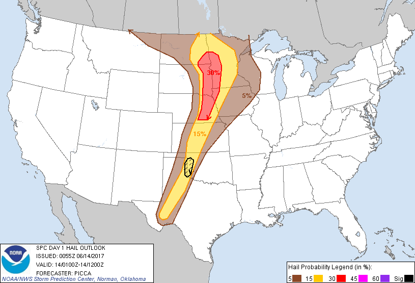
...Southern/Central Plains...
Thunderstorms have blossomed along the dryline this evening,
stretching from eastern Nebraska to west Texas. Steep lapse rates
and adequate effective shear values will maintain a threat of
supercells capable of large hail and damaging winds through the late
evening hours. However, with stronger large-scale ascent removed to
the north, storms will encounter increasing convective inhibition as
they progress east, resulting in a downward trend in the severe
threat through the early overnight hours.
..Picca.. 06/14/2017
CLICK TO GET WUUS01 PTSDY1 PRODUCT
NOTE: THE NEXT DAY 1 OUTLOOK IS SCHEDULED BY 0600Z