New York, NY...Chicago, IL...Memphis, TN...Charlotte, NC...Milwaukee, WI...
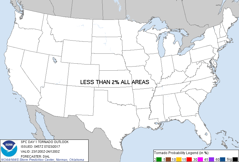
Probabilistic Tornado Graphic
Probability of a tornado within 25 miles of a point. Hatched Area: 10% or greater probability of EF2 - EF5 tornadoes within 25 miles of a point.
Day 1 Tornado Risk
Area (sq. mi.)
Area Pop.
Some Larger Population Centers in Risk Area
No Risk Areas Forecast
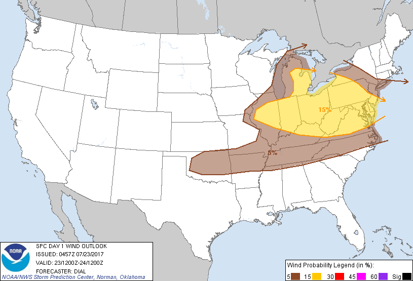
Probabilistic Damaging Wind Graphic
Probability of damaging thunderstorm winds or wind gusts of 50 knots or higher within 25 miles of a point. Hatched Area: 10% of greater probability of wind gusts 65 knots or greater within 25 miles of a point.
SPC AC 230457
Day 1 Convective Outlook
NWS Storm Prediction Center Norman OK
1157 PM CDT Sat Jul 22 2017
Valid 231200Z - 241200Z
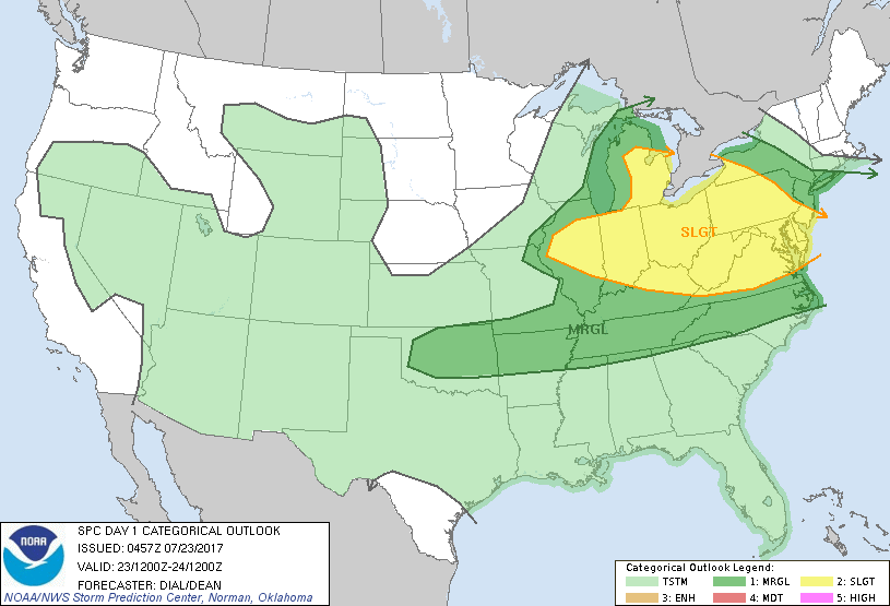
...THERE IS A SLIGHT RISK OF SEVERE THUNDERSTORMS OVER A PORTION OF
THE OHIO VALLEY...GREAT LAKES AND MIDDLE ATLANTIC...
...THERE IS A MARGINAL RISK OF SEVERE THUNDERSTORMS FROM OKLAHOMA
THROUGH THE MID SOUTH...
...SUMMARY...
A broad zone widely scattered to scattered thunderstorms and
isolated severe risk will reside over portions of the Great Lakes,
Ohio Valley and central Appalachians area today. Isolated strong to
severe storms may also occur from Oklahoma eastward to the Mid-South
this afternoon.
...Synopsis...
Shortwave trough over northern MN will continue southeast through
the Great Lakes with a general amplification of synoptic trough over
the eastern states today. Several vorticity maxima will rotate
through this regime. At the surface a synoptic front will extend
from OK northeast into the Ohio Valley region then east into the
Middle Atlantic area. South of this feature, several convectively
enhanced boundaries will reside in warm sector.
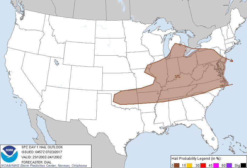
...Ohio Valley, Great Lakes into the Middle Atlantic region...
Broad and moist warm sector will reside in this region, and areas of
diabatic warming will contribute to moderate instability during the
day. The combination of forcing for ascent associated with vorticity
maxima migrating through amplifying upper trough, residual
boundaries, terrain as well as the synoptic front will all provide
mechanisms for storms to develop in the weakly capped warm sector. A
secondary frontal surge may accompany the primary shortwave trough
the upper Great Lakes and upper Midwest region. Winds aloft will
increase as upper trough amplifies with unidirectional westerly flow
and 30-40 kt effective bulk shear. Mixed modes with both multicells
and a few supercells are probable, and some storms evolving into
clusters. Isolated damaging wind and hail will be the primary
threats through early evening.
...Oklahoma through the Mid South...
Storms are expected to develop along front and residual outflow
boundaries as well as over the higher terrain from OK through the
Carolinas region. This area will remain south of the stronger flow
aloft with weak shear supportive of multicells. However, the
thermodynamic environment with high precipitable water and moderate
to strong instability will promote a risk for downburst winds and
hail as the boundary layer destabilizes during the afternoon.
..Dial/Dean.. 07/23/2017
CLICK TO GET WUUS01 PTSDY1 PRODUCT
NOTE: THE NEXT DAY 1 OUTLOOK IS SCHEDULED BY 1300Z