Probability of a tornado within 25 miles of a point. Hatched Area: 10% or greater probability of EF2 - EF5 tornadoes within 25 miles of a point.
Day 1 Tornado Risk
Area (sq. mi.)
Area Pop.
Some Larger Population Centers in Risk Area
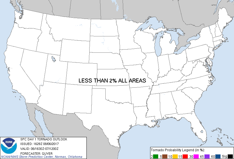
No Risk Areas Forecast
Probabilistic Damaging Wind Graphic
Probability of damaging thunderstorm winds or wind gusts of 50 knots or higher within 25 miles of a point. Hatched Area: 10% of greater probability of wind gusts 65 knots or greater within 25 miles of a point.
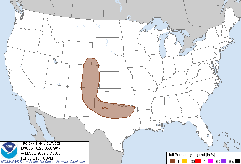
Probability of hail 1" or larger within 25 miles of a point. Hatched Area: 10% or greater probability of hail 2" or larger within 25 miles of a point.
Day 1 Hail Risk
Area (sq. mi.)
Area Pop.
Some Larger Population Centers in Risk Area
5 %
183,310
13,126,824
Dallas, TX...Fort Worth, TX...Denver, CO...Colorado Springs, CO...Arlington, TX...
   SPC AC 061629

   Day 1 Convective Outlook
   NWS Storm Prediction Center Norman OK
   1129 AM CDT Sun Aug 06 2017

   Valid 061630Z - 071200Z

   ...THERE IS A MARGINAL RISK OF SEVERE THUNDERSTORMS FROM THE
   CENTRAL/SOUTHERN HIGH PLAINS TO THE TENNESSEE VALLEY...

   ...SUMMARY...
   Isolated severe storms will be possible mainly this afternoon into
   early evening from portions of the Mid-South to southern Oklahoma
   and north Texas, and also across the central and southern High
   Plains. Isolated damaging wind gusts and some hail will be the
   primary severe-weather threats.

   ...Mid-South including portions of AR/KY/TN/MS...
   A long-lived MCS (and apparent MCV) continues to move
   east-southeastward across AR and the Ark-La-Tex vicinity late this
   morning. Although plentiful cloud cover currently precedes the
   MCS/MCV, some rejuvenation is likely to occur with a downstream
   intensification of storms this evening. The overall extent of such a
   severe threat is a bit questionable, although it appears that at
   least some strong to severe thunderstorms capable of locally
   damaging winds may occur from eastern AR eastward into western
   portions of TN/KY and northern MS.

   ...Southern OK/North TX and Ark-La-Tex vicinity...
   To the west of the slowly weakening MCS at late morning, an outflow
   boundary and related zone of differential heating should be a factor
   for convective redevelopment later today in the general vicinity of
   the Red River. Relatively weak deep-layer shear but strong
   instability and ample moisture indicate the risk of occasional
   severe wind gusts in the stronger cells, along with some hail. These
   storms are expected to develop south-southeastward across north TX
   and the nearby Ark-La-Tex through the evening.

   ...Central/southern High Plains...
   Thunderstorms will form once again today over the foothills and
   higher terrain of eastern CO/NM/WY as well as across western NE.
   Sufficiently strong northwesterly flow aloft will support the risk
   of a few organized/rotating storms capable of gusty winds and hail.
   However, the overall coverage of severe storms is likely to remain
   sparse.

   ..Guyer/Jirak.. 08/06/2017

   CLICK TO GET WUUS01 PTSDY1 PRODUCT

   NOTE: THE NEXT DAY 1 OUTLOOK IS SCHEDULED BY 2000Z