Probability of a tornado within 25 miles of a point. Hatched Area: 10% or greater probability of EF2 - EF5 tornadoes within 25 miles of a point.
Day 1 Tornado Risk
Area (sq. mi.)
Area Pop.
Some Larger Population Centers in Risk Area
No Risk Areas Forecast
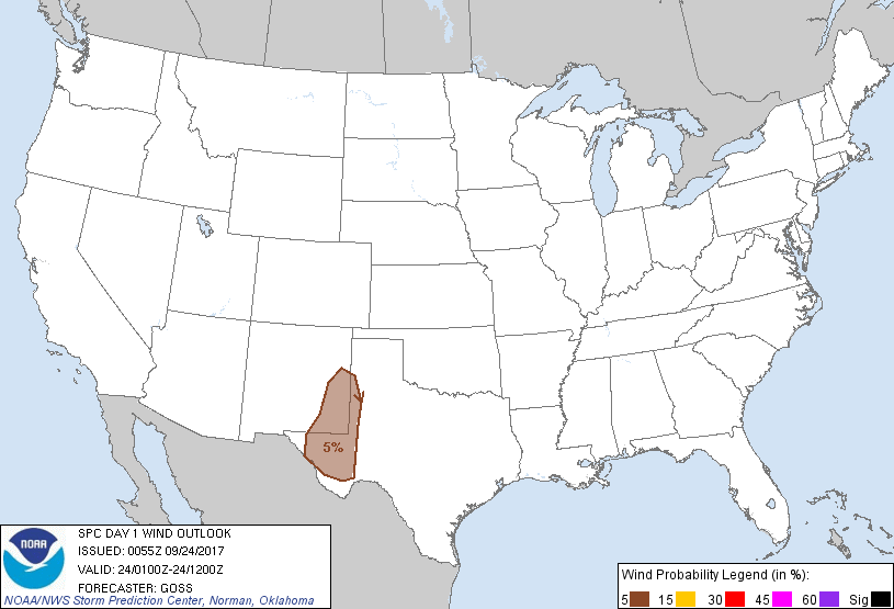
Probabilistic Damaging Wind Graphic
Probability of damaging thunderstorm winds or wind gusts of 50 knots or higher within 25 miles of a point. Hatched Area: 10% of greater probability of wind gusts 65 knots or greater within 25 miles of a point.
SPC AC 240055
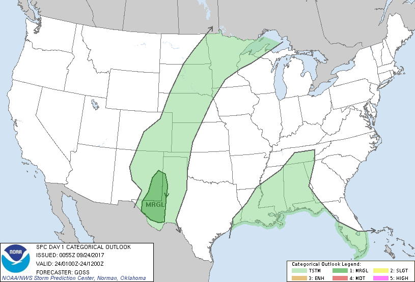
Day 1 Convective Outlook
NWS Storm Prediction Center Norman OK
0755 PM CDT Sat Sep 23 2017
Valid 240100Z - 241200Z
...THERE IS A MARGINAL RISK OF SEVERE THUNDERSTORMS ACROSS THE
SOUTHEAST NEW MEXICO/FAR WEST TEXAS AREA......
...SUMMARY...
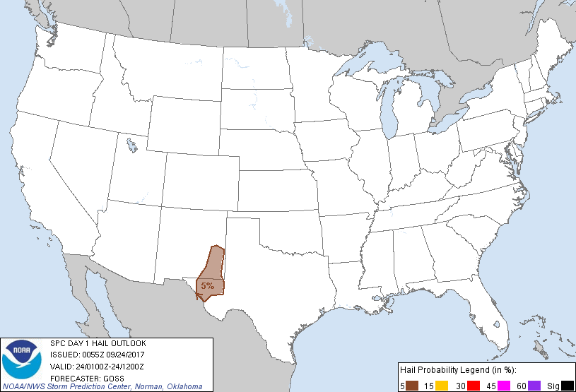
Isolated strong/severe storms -- capable of producing locally
damaging wind gusts and marginal hail -- may persist for another few
hours across parts of southern High Plains including far West Texas.
...Southeast New Mexico and far West Texas and vicinity...
While a broad convective band extending from the north-central U.S.
south-southwest to far West Texas persists, overall/gradual
weakening of the convection continues with a combination of diurnal
cooling/stabilization, and outflow largely undercutting storms
across the northern and central U.S.
The most vigorous storms are ongoing across southeast New Mexico and
far West Texas at this time. In this area, ample instability (1000
to 1500 J/kg mixed-layer CAPE per objective analyses) and ample
deep-layer shear indicated across the area will continue to support
limited hail/wind risk. Eventually, stabilization of the boundary
layer should result in a gradual ramp-down of convective
organization, but marginal severe risk may linger for the next 2-3
hours or so.
..Goss.. 09/24/2017
CLICK TO GET WUUS01 PTSDY1 PRODUCT
NOTE: THE NEXT DAY 1 OUTLOOK IS SCHEDULED BY 0600Z