SPC AC 271255
Day 1 Convective Outlook
NWS Storm Prediction Center Norman OK
0755 AM CDT Wed Sep 27 2017
Valid 271300Z - 281200Z
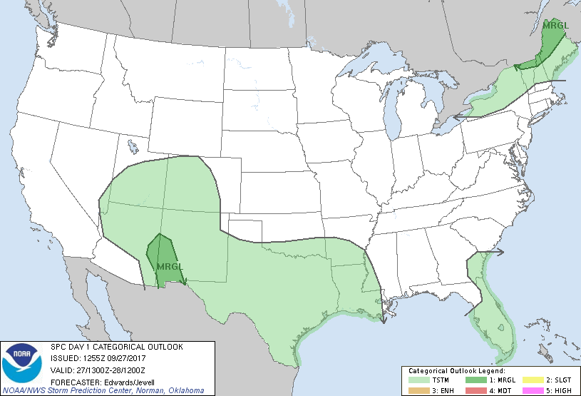
...THERE IS A MARGINAL RISK OF SEVERE THUNDERSTORMS OVER PARTS OF
NORTHERN NEW ENGLAND...
...THERE IS A MARGINAL RISK OF SEVERE THUNDERSTORMS OVER PARTS OF
EASTERN ARIZONA TO SOUTHWESTERN NEW MEXICO...
...SUMMARY...
Marginal risks for severe thunderstorms exist this afternoon into
early evening, over parts of northern New England, eastern Arizona
and southwestern New Mexico.
...Synopsis...
In mid/upper levels, troughing will persist over the western U.S.,
but as part of a height-pattern evolution toward a Rex configuration
from the end of this period into day 2. By 12Z, the northeastern
part of a high-amplitude northeastern Pacific ridge should break
off, forming a closed, roughly 583-decameter 500-mb high over the
northern Rockies. Meanwhile, broadly cyclonic flow will continue
over most of CA, the Great Basin, southern Intermountain region and
southern Rockies. The related mid/upper-level low over the lower
Colorado River Valley area should weaken somewhat and eject
northeastward toward the Four Corners or southern UT.
Meanwhile, synoptic-scale, northern-stream troughing will amplify
somewhat and shift eastward over the Great Lakes and eastern Canada.
A strong associated shortwave trough -- now evident in moisture-
channel imagery over northern ON -- will move eastward across
central/southern QC through the period, deamplifying somewhat as a
trailing perturbation moves over northern ON.
At the surface, the cold front related to the lead northern-stream
shortwave was analyzed at 11Z from Georgian Bay southwestward across
northwestern OH, southwestern IN, central AR, and into a precip
plume between SAT-DRT. By 00Z, the front should extend from eastern
QC across northern NY, the upper Ohio Valley, to the upper TX
coastal plain and Coahuila, arching northwestward over the
Chihuahuan Desert to south-central NM. By 12Z, the front should
extend from Downeast Maine through the northwestern quadrant of the
T.S. Maria vortex over the Atlantic, to the north-central/
northwestern Gulf and north-central Mexico.
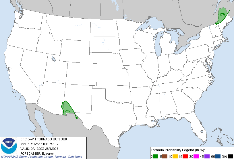
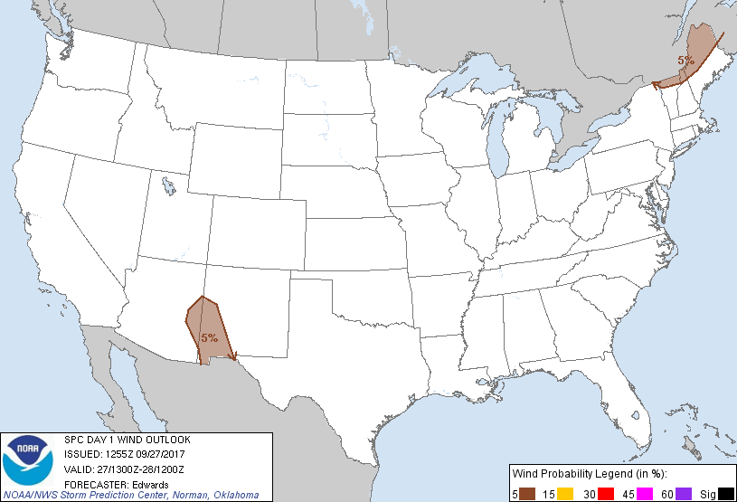
...Northern New England...
One or two broken bands of thunderstorms should develop mainly over
southern QC and organize as they move east this afternoon and early
evening. Activity should form along and ahead of the cold front,
aided by a combination of low-level theta-e advection and related
moistening, diabatic warming at the surface, frontal lift, and
large-scale DCVA/ascent aloft ahead of the lead perturbation.
Modified model soundings yield MLCAPE generally 500-1000 J/kg,
limited from being much stronger by the presence of weak midlevel
lapse rates. Still, favorable deep shear (e.g., effective-shear
magnitudes 40-50 kt) is expected as the mid/upper trough approaches
and winds aloft strengthen. This should support the development of
a mixed-mode scenario with multicells, small bows and supercells all
possible.
...Eastern AZ to southwestern NM...
Widely scattered thunderstorms are expected to form this afternoon
from the eastern part of the Mogollon Rim eastward and southeastward
across nearby portions of NM west of the Rio Grande, with isolated
severe gusts/hail possible.
Low-level moisture continues to advect into this region to the
northwest of the cold front, transported amidst post-frontal net
easterly components of orographically influenced strength and
duration. This process should continue through the afternoon. That
process will combine with pockets of sustained diabatic surface
heating to boost buoyancy, resulting in MLCAPE generally 500-1000
J/kg over persistent cloud-free areas that also support subcloud
mixing. The theta-e increase, along with localized terrain lift,
will reduce MLCINH and support convective development. A 40-50-kt
500-mb jetlet shifting around the southeastern quadrant of the
mid/upper-level cyclone, combined with those low-level easterly
components, will contribute to favorable deep shear for a few
supercells. Forecast soundings suggest effective-shear magnitudes
around 50 kt, with elongated 0-3-km hodographs permitting SRH
150-200 J/kg.
..Edwards/Jewell.. 09/27/2017
CLICK TO GET WUUS01 PTSDY1 PRODUCT
NOTE: THE NEXT DAY 1 OUTLOOK IS SCHEDULED BY 1630Z
|