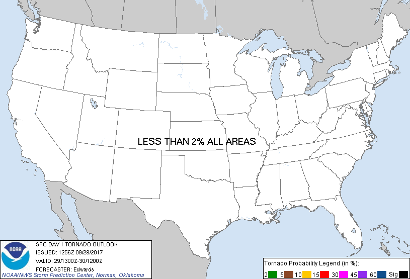
Probability of a tornado within 25 miles of a point. Hatched Area: 10% or greater probability of EF2 - EF5 tornadoes within 25 miles of a point.
Day 1 Tornado Risk
Area (sq. mi.)
Area Pop.
Some Larger Population Centers in Risk Area
No Risk Areas Forecast
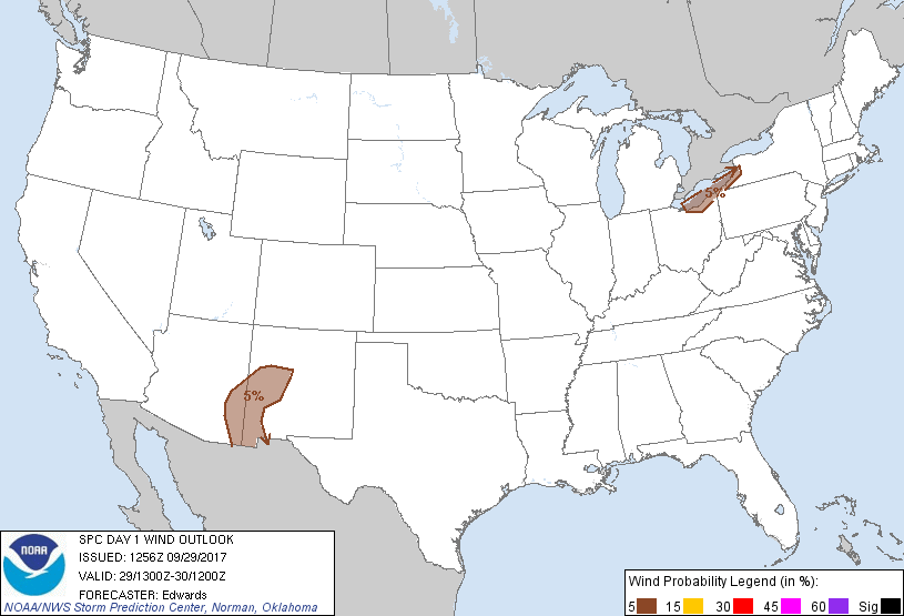
Probabilistic Damaging Wind Graphic
Probability of damaging thunderstorm winds or wind gusts of 50 knots or higher within 25 miles of a point. Hatched Area: 10% of greater probability of wind gusts 65 knots or greater within 25 miles of a point.
SPC AC 291256
Day 1 Convective Outlook
NWS Storm Prediction Center Norman OK
0756 AM CDT Fri Sep 29 2017
Valid 291300Z - 301200Z
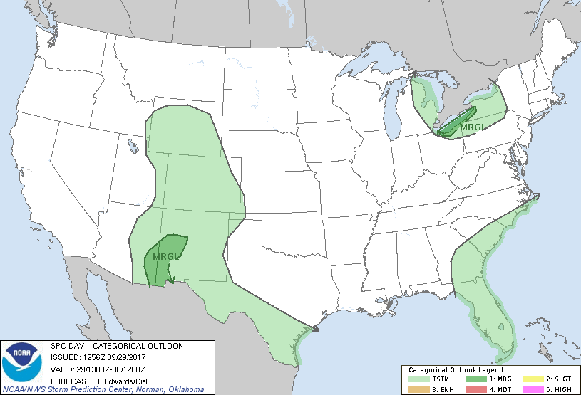
...THERE IS A MARGINAL RISK OF SEVERE THUNDERSTORMS NEAR THE
SOUTHEASTERN SHORE OF LAKE ERIE...
...THERE IS A MARGINAL RISK OF SEVERE THUNDERSTORMS OVER PARTS OF
WESTERN NEW MEXICO AND SOUTHEASTERN ARIZONA...
...SUMMARY...
Hail and gusts near severe levels may occur with a few thunderstorms
this afternoon and early evening near Lake Erie, and over the
western New Mexico/southeastern Arizona region.
...Synopsis...
In mid/upper levels, a progressive and somewhat amplified
northern-stream pattern will lead to breakdown of the short-lived
Rex configuration now over the northern Rockies and Intermountain
West. A strong shortwave trough -- now evident in moisture-channel
imagery just offshore the Pacific Northwest -- will move inland
during the next several hours, followed by weaker shortwaves and a
speed max to its south and southwest. By the end of the period, the
net effect should be negatively tilted synoptic-scale troughing from
the interior Northwest to the lower Colorado River region. That
will contribute to weakening/ejection of the vortex now centered
over southwestern WY, with a residual/open-wave trough over the
northern High Plains by 12Z. Downstream, ridging will shift
eastward across the central/northern Plains toward the mid/upper
Mississippi Valley. An intense, northwest-flow shortwave trough --
currently crossing the upper Great Lakes, should reach southeastern
ON, Lake Erie and OH by 00Z. By 12Z, the trough should extend from
portions of New England and the interior Mid-Atlantic to parts of
the central/southern Appalachians.
At the surface, a cold front extended from offshore New England
southwestward over the Carolinas and southern AL, to the LA coastal
area and northeastern Mexico. This boundary should move slowly
southward/southeastward over the northern Gulf and northern FL.
Meanwhile, a surface low related to the leading northern-stream
shortwave trough was analyzed over Lake Huron, and should move
southeastward to near NYC by 12Z, with a cold front trailing to its
southwest.
...Lake Erie vicinity...
Showers and widely scattered thunderstorms should move rapidly off
Lake Erie mid/late this afternoon, with origins over the lake and
perhaps in more moisture-starved areas upstream in Lower MI and ON.
Some hail and damaging gusts may occur. This peculiar scenario
resembles others responsible for early-winter, convectively intense,
lake-effect thundersnow events -- but earlier in the cool season,
with wet thunderstorms instead, and thermodynamic profiles shifted
to the right (warmer) on sounding diagrams.
Strong large-scale/deep-layer lift and intensifying midlevel flow
will precede the approaching mid/upper trough. This will include
favorable low-level convergence near the surface low and trailing
cold front. Steepening low/middle-level lapse rates over the lake
will yield enough buoyancy for strong convection including
thunderstorms. Modified forecast soundings yield MLCAPE values
400-700 J/kg over the lake and near the immediate shoreline.
Similarly to winter snow events ahead of strong shortwave troughs,
forecast buoyancy profiles are relatively shallow. As such, only
small adjustments to surface conditions on and near the lake yield
large changes not only in specific MLCAPE values, but also, great
variation in effective shear. The latter is related to the
effective calculations' dependence on storm depth, and resultant
sampling (or not) of the base layer of the most intense midlevel
westerlies. Regardless, cloud-layer shear will be strong, amidst
nearly unidirectional wind profiles featuring 50-70-kt flow near a
roughly 500-mb equilibrium level. These profiles should support
organized convection over water, some of which may reach land with a
risk of marginal-severe wind/hail.
...AZ/NM...
Widely scattered thunderstorms should develop this afternoon into
early evening, offering the potential for isolated severe hail and
damaging gusts. Surface dew points upper 40s F to near 60 will
combine with diabatic surface heating to remove MLCINH and boost
peak MLCAPE into the 1000-1500 J/kg range over much of the outlook
area, with lifting aided by localized orographic processes.
Well-mixed subcloud layers should contribute to the potential for
maintenance of gusts/hail to the surface. Though the parent
mid/upper trough will be weakening/ejecting away from the area,
enough flow aloft should remain, in concert with favorable
directional shear, to yield 30-40 kt effective-shear magnitudes in
support of marginal storm organization.
..Edwards/Dial.. 09/29/2017
CLICK TO GET WUUS01 PTSDY1 PRODUCT
NOTE: THE NEXT DAY 1 OUTLOOK IS SCHEDULED BY 1630Z