Probability of a tornado within 25 miles of a point. Hatched Area: 10% or greater probability of EF2 - EF5 tornadoes within 25 miles of a point.
Day 1 Tornado Risk
Area (sq. mi.)
Area Pop.
Some Larger Population Centers in Risk Area
No Risk Areas Forecast
Probabilistic Damaging Wind Graphic
Probability of damaging thunderstorm winds or wind gusts of 50 knots or higher within 25 miles of a point. Hatched Area: 10% of greater probability of wind gusts 65 knots or greater within 25 miles of a point.
Day 1 Wind Risk
Area (sq. mi.)
Area Pop.
Some Larger Population Centers in Risk Area
No Risk Areas Forecast
Probabilistic Large Hail Graphic
Probability of hail 1" or larger within 25 miles of a point. Hatched Area: 10% or greater probability of hail 2" or larger within 25 miles of a point.
Day 1 Hail Risk
Area (sq. mi.)
Area Pop.
Some Larger Population Centers in Risk Area
No Risk Areas Forecast
SPC AC 130046
Day 1 Convective Outlook
NWS Storm Prediction Center Norman OK
0746 PM CDT Thu Oct 12 2017
Valid 130100Z - 131200Z
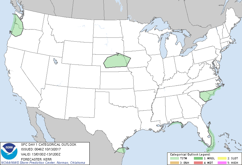
...NO SEVERE THUNDERSTORM AREAS FORECAST...
...SUMMARY...
The risk of severe storms appears negligible across the U.S.
tonight.
...01Z Outlook Update...
Across the Pacific Northwest, weak destabilization has been
sufficient to support scattered late afternoon thunderstorms
near/just west of the southern Washington/ northern Oregon Cascades.
Orographic forcing for ascent contributing to convective development
has been enhanced by large-scale lift associated with an inland
migrating short wave impulse. As the latter forcing shifts east of
the Cascades and boundary layer cooling commences, the risk for
additional thunderstorm activity may become increasingly negligible
by 02-03Z.
Elsewhere, areas of scattered weak thunderstorm development across
parts of the Southeast are already in the process of diminishing
with the loss of daytime heating. However, elevated moisture return
to a zone of strengthening lower/mid tropospheric warm advection
could contribute to increasing thunderstorm probabilities overnight
(particularly toward the 09-12Z time frame) across parts of
central/eastern Nebraska and adjacent portions of the mid Missouri
Valley.
..Kerr.. 10/13/2017
CLICK TO GET WUUS01 PTSDY1 PRODUCT
NOTE: THE NEXT DAY 1 OUTLOOK IS SCHEDULED BY 0600Z