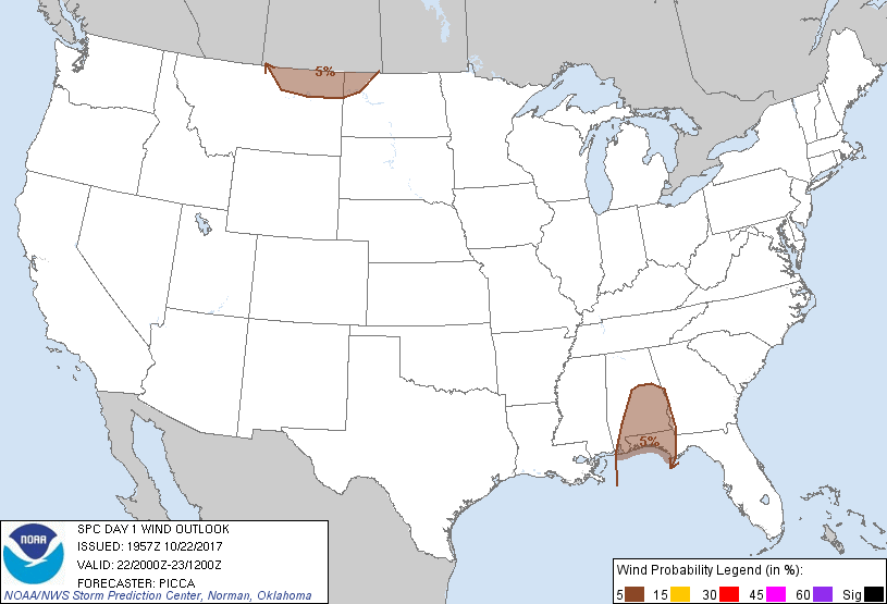
Probability of damaging thunderstorm winds or wind gusts of 50 knots or higher within 25 miles of a point. Hatched Area: 10% of greater probability of wind gusts 65 knots or greater within 25 miles of a point.
Probability of hail 1" or larger within 25 miles of a point. Hatched Area: 10% or greater probability of hail 2" or larger within 25 miles of a point.
Day 1 Hail Risk
Area (sq. mi.)
Area Pop.
Some Larger Population Centers in Risk Area
No Risk Areas Forecast
SPC AC 221957
Day 1 Convective Outlook
NWS Storm Prediction Center Norman OK
0257 PM CDT Sun Oct 22 2017
Valid 222000Z - 231200Z
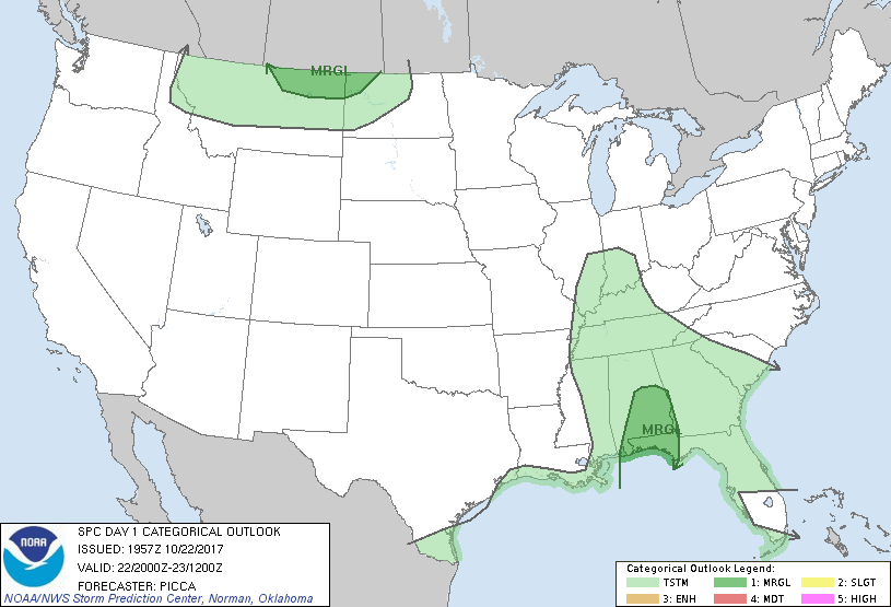
...THERE IS A MARGINAL RISK OF SEVERE THUNDERSTORMS ACROSS
SOUTHERN/CENTRAL ALABAMA AND THE WESTERN FLORIDA PANHANDLE...
...THERE IS A MARGINAL RISK OF SEVERE THUNDERSTORMS ACROSS NORTHEAST
MONTANA AND NORTHWEST NORTH DAKOTA...
...SUMMARY...
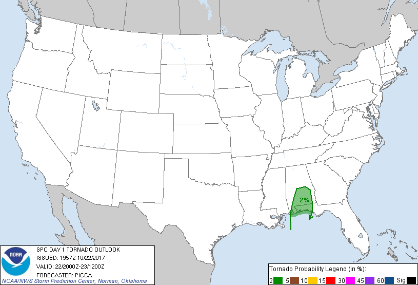
Isolated damaging gusts and a brief tornado or two will remain
possible into tonight across southern Alabama and the western
Florida Panhandle. Isolated strong/damaging gusts may also be
possible through this evening across the northern High Plains.
...Discussion...
Only noteworthy change is the removal of Louisiana and Mississippi
from severe probabilities, as the convective cold pool has already
advanced east through these areas. Ahead of the cold pool, moist
southeasterly low-level flow will maintain sufficient shear and
surface-based buoyancy for isolated damaging gusts and a tornado or
two into the overnight hours.
..Picca.. 10/22/2017
.PREV DISCUSSION... /ISSUED 1126 AM CDT Sun Oct 22 2017/
...Southeast LA today and southern AL through tonight...
A midlevel trough approaching the MS Valley could briefly evolve
into a closed low over the Mid South, prior to beginning to
accelerate north-northeastward as a more open wave Monday. An
associated surface cold front will continue eastward across
LA/MS/AL, to the south of weak cyclogenesis across the TN and lower
OH Valleys. Outflow from overnight convection has become the
effective cold front across LA/MS this morning, and this boundary
will continue to move eastward/southeastward through the day.
Farther east, a zone of low-level warm advection, on the nose of the
richer low-level moisture and highest PW, has focused convection
from the MS coast into southwest AL. Several storms with supercell
structures have been observed, per the Mobile VWP hodograph, though
the storms thus far have weakened while encountering a more stable
environment inland.
Some low-end damaging wind potential will accompany the outflow
across southeast LA today, and there will continue to be a low-end
threat for rotating storms and a brief tornado along the southeast
MS and southwest AL coasts. Gradual destabilization is underway to
the east of the ongoing warm advection storms, and it appears there
will be enough inland warming and moistening to support some
expansion of the marginal risk area in AL through tonight.
...Northern MT/northwestern ND this afternoon/evening...
A strong mid-upper jet accompanying a shortwave trough will progress
eastward from the northern Rockies to the northern High Plains,
before turning southeastward around the northeastern periphery of a
ridge along the Pacific coast. Surface heating and residual
low-level moisture should be sufficient to support very weak
surface-based CAPE this afternoon/evening from northern MT into
northwestern ND, along and immediately south of the path of the
associated surface cyclone. Given steepening low-level lapse rates
with the weak buoyancy, some low-topped convection could result in
downward transport of high-momentum flow just above the surface.
CLICK TO GET WUUS01 PTSDY1 PRODUCT
NOTE: THE NEXT DAY 1 OUTLOOK IS SCHEDULED BY 0100Z