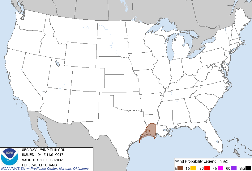
Probability of damaging thunderstorm winds or wind gusts of 50 knots or higher within 25 miles of a point. Hatched Area: 10% of greater probability of wind gusts 65 knots or greater within 25 miles of a point.
Probability of hail 1" or larger within 25 miles of a point. Hatched Area: 10% or greater probability of hail 2" or larger within 25 miles of a point.
Day 1 Hail Risk
Area (sq. mi.)
Area Pop.
Some Larger Population Centers in Risk Area
No Risk Areas Forecast
SPC AC 011244
Day 1 Convective Outlook
NWS Storm Prediction Center Norman OK
0744 AM CDT Wed Nov 01 2017
Valid 011300Z - 021200Z
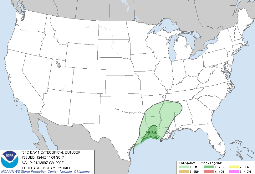
...THERE IS A MARGINAL RISK OF SEVERE THUNDERSTORMS SOUTHWEST LA/FAR
SOUTHEAST TX...
...SUMMARY...
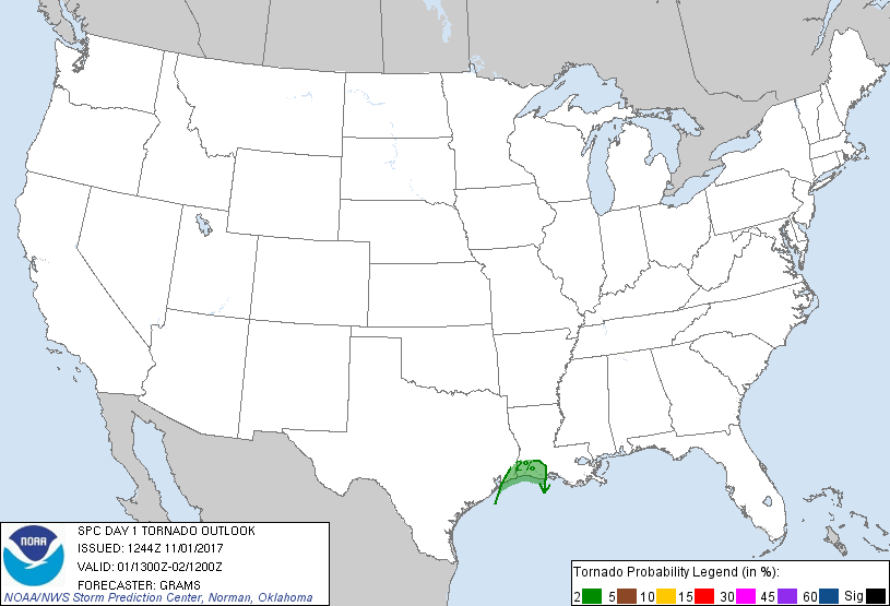
A brief tornado and locally damaging winds will remain possible
through early afternoon across southwest Louisiana and far southeast
Texas.
...Sabine Valley...
Have maintained Marginal risk probabilities for tornado and wind,
with these threats expected to wane by late afternoon.
A broad swath of showers and sporadic embedded thunderstorms are
ongoing within a warm-conveyor belt across eastern TX into the Lower
MS Valley downstream of a 1011 mb surface cyclone over southeast TX.
Guidance is highly consistent in dissipating this cyclone along a
decaying frontal zone by midday, with convection diminishing by 21Z.
While near 70 F surface dew points have reached the mouth of the
Sabine River, inland destabilization will likely remain
limited/spatially confined by the ongoing rain swath and attendant
cloud coverage slowing boundary-layer heating. The 12Z Lake Charles
sounding sampled moist adiabatic lapse rates and no surface-based
instability within this convective band and just north of the richer
marine air. The NAM and GFS appear too aggressive with
destabilization later this morning with the RAP and especially the
ECMWF appearing more realistic.
0-1 km shear of 30-35 kt as sampled by the 12Z Lake Charles sounding
and VWP data will remain sufficient for a brief tornado/localized
damaging wind risk, mainly near the coastal section of the Lower
Sabine Valley where weak surface-based instability should exist.
While more robust destabilization will likely occur to the west of
early-day convection resulting in a favorable CAPE-shear parameter
space, storm redevelopment at peak heating appears very unlikely
with minimal forcing for ascent and negligible convective signal in
guidance.
..Grams/Mosier.. 11/01/2017
CLICK TO GET WUUS01 PTSDY1 PRODUCT
NOTE: THE NEXT DAY 1 OUTLOOK IS SCHEDULED BY 1630Z