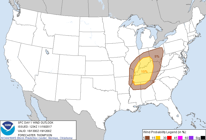
Probability of damaging thunderstorm winds or wind gusts of 50 knots or higher within 25 miles of a point. Hatched Area: 10% of greater probability of wind gusts 65 knots or greater within 25 miles of a point.
SPC AC 181234
Day 1 Convective Outlook
NWS Storm Prediction Center Norman OK
0634 AM CST Sat Nov 18 2017
Valid 181300Z - 191200Z
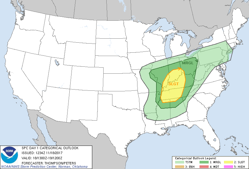
...THERE IS A SLIGHT RISK OF SEVERE THUNDERSTORMS MAINLY THIS
AFTERNOON/EVENING FOR THE LOWER OH VALLEY AND PARTS OF THE TN
VALLEY...
...THERE IS A MARGINAL RISK OF SEVERE THUNDERSTORMS SURROUNDING THE
SLIGHT RISK AREA...
...SUMMARY...
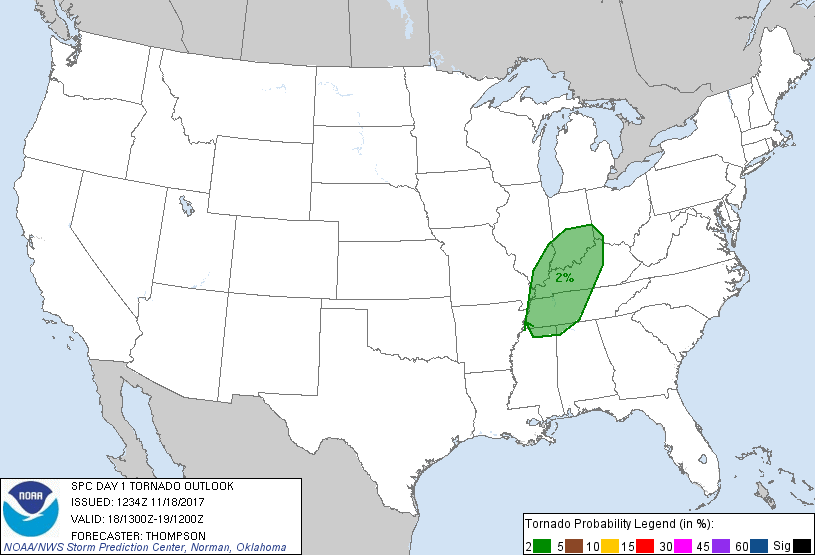
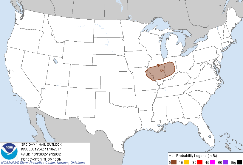
Thunderstorms capable of severe wind gusts, marginal hail, or a
brief tornado will be possible, mainly this afternoon across parts
of the Ohio and Tennessee Valley regions.
...OH/TN Valley regions through late evening...
A surface cyclone in MO this morning will deepen while moving
east-northeastward across the OH Valley to the lower Great Lakes by
tonight, in advance of an amplifying midlevel shortwave trough. An
associated surface cold front will surge eastward from MO/AR this
morning to the Appalachians by early tonight. Boundary-layer
dewpoints in the 60s will contribute to a narrow corridor of weak
buoyancy in the pre-frontal warm sector. However, clouds will limit
surface heating and midlevel lapse rates will weaken with eastward
extent, limiting the degree of warm sector buoyancy.
Ongoing elevated convection in the zone of stronger forcing for
ascent (in advance of the surface cyclone) will persist into the
day, with some threat for isolated large hail given the lingering
steep lapse rate feed from the west-southwest. Otherwise, a narrow
band of low-topped convection should form by midday in the band of
ascent along the cold front as ascent/moistening weakens the cap,
and then move quickly eastward through the afternoon/evening across
the OH/TN Valley regions. Though buoyancy will remain weak, 50-60
kt flow just above the surface and strong low-level shear will
contribute to the threat for damaging winds, and perhaps an embedded
tornado or two, with the forced band of convection. The threat for
damaging winds should diminish by late evening as the cold front
overturns the remaining weakly unstable warm sector.
..Thompson/Peters.. 11/18/2017
CLICK TO GET WUUS01 PTSDY1 PRODUCT
NOTE: THE NEXT DAY 1 OUTLOOK IS SCHEDULED BY 1630Z