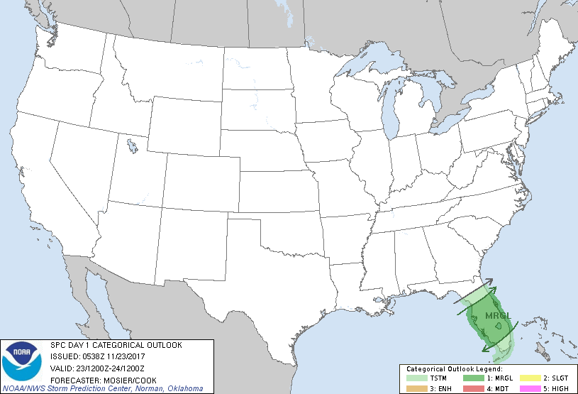
Tampa, FL...St. Petersburg, FL...Orlando, FL...Coral Springs, FL...Cape Coral, FL...
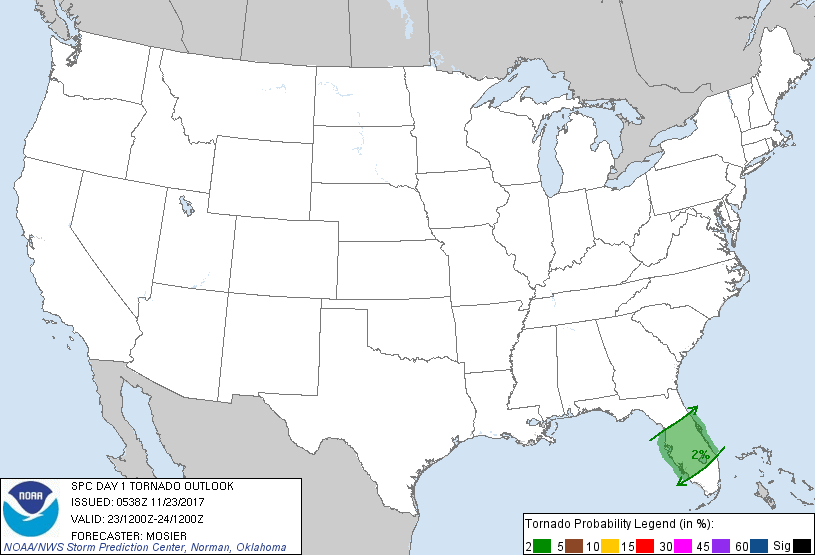
Probabilistic Tornado Graphic
Probability of a tornado within 25 miles of a point. Hatched Area: 10% or greater probability of EF2 - EF5 tornadoes within 25 miles of a point.
Day 1 Tornado Risk
Area (sq. mi.)
Area Pop.
Some Larger Population Centers in Risk Area
2 %
25,692
9,338,402
Tampa, FL...St. Petersburg, FL...Orlando, FL...Cape Coral, FL...Port St. Lucie, FL...
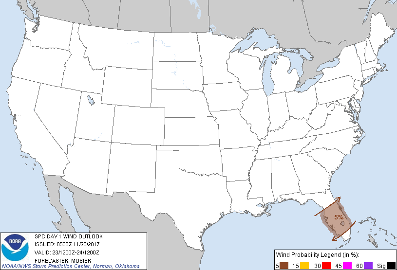
Probabilistic Damaging Wind Graphic
Probability of damaging thunderstorm winds or wind gusts of 50 knots or higher within 25 miles of a point. Hatched Area: 10% of greater probability of wind gusts 65 knots or greater within 25 miles of a point.
Day 1 Wind Risk
Area (sq. mi.)
Area Pop.
Some Larger Population Centers in Risk Area
5 %
29,714
10,856,646
Tampa, FL...St. Petersburg, FL...Orlando, FL...Coral Springs, FL...Cape Coral, FL...
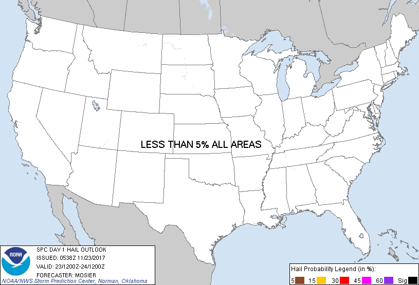
Probabilistic Large Hail Graphic
Probability of hail 1" or larger within 25 miles of a point. Hatched Area: 10% or greater probability of hail 2" or larger within 25 miles of a point.
Day 1 Hail Risk
Area (sq. mi.)
Area Pop.
Some Larger Population Centers in Risk Area
No Risk Areas Forecast
   SPC AC 230538

   Day 1 Convective Outlook
   NWS Storm Prediction Center Norman OK
   1138 PM CST Wed Nov 22 2017

   Valid 231200Z - 241200Z

   ...THERE IS A MARGINAL RISK OF SEVERE THUNDERSTORMS ACROSS THE
   CENTRAL AND SOUTHERN FL PENINSULA...

   ...SUMMARY...
   A few strong to severe thunderstorms are possible across the central
   and southern Florida Peninsula today.

   ...Central/Southern FL Peninsula...
   Shortwave trough currently moving through the central Gulf of Mexico
   will continue eastward/northeastward during the day as it pivots
   through the base of the longwave upper trough extending across the
   eastern CONUS. An attendant surface low will move eastward just
   ahead of the upper system, weakening as it approaches the FL
   Peninsula before eventually re-strengthening off the SC coast.
   Showers and isolated thunderstorms are anticipated within the
   warm-air advection zone near the warm front, which is expected to
   extend east-northeastward across the northern FL Peninsula for much
   of the day. Despite strongly veered wind profiles, limited
   destabilization should temper updraft strength and preclude any
   strong/severe thunderstorms.

   Farther south, greater potential for diurnal heating exists within
   the pre-frontal warm sector, which, when coupled with favorable
   low-level moisture will support modest instability. HREF
   probabilities of MLCAPE over 1000 J/kg are 60 to 80%. As lift from
   both the approaching shortwave trough and cold front interacts with
   the instability, isolated to scattered thunderstorms are
   anticipated. Mid-level flow will be strengthening throughout the
   day, increasing the potential for a few stronger, more organized
   updrafts capable of damaging wind gusts and perhaps a brief tornado.
   Additionally, given the strength of the mid-level flow, some
   isolated hail is also possible, particularly across southeast FL
   where the strong diurnal heating is expected. However, displacement
   between the stronger flow aloft (northern FL) and better instability
   (southern FL) as well as poor lapse rates results in hail
   probability less than 5%.

   ..Mosier/Cook.. 11/23/2017

   CLICK TO GET WUUS01 PTSDY1 PRODUCT

   NOTE: THE NEXT DAY 1 OUTLOOK IS SCHEDULED BY 1300Z