Probability of a tornado within 25 miles of a point. Hatched Area: 10% or greater probability of EF2 - EF5 tornadoes within 25 miles of a point.
Day 1 Tornado Risk
Area (sq. mi.)
Area Pop.
Some Larger Population Centers in Risk Area
No Risk Areas Forecast
Probabilistic Damaging Wind Graphic
Probability of damaging thunderstorm winds or wind gusts of 50 knots or higher within 25 miles of a point. Hatched Area: 10% of greater probability of wind gusts 65 knots or greater within 25 miles of a point.
Day 1 Wind Risk
Area (sq. mi.)
Area Pop.
Some Larger Population Centers in Risk Area
No Risk Areas Forecast
Probabilistic Large Hail Graphic
Probability of hail 1" or larger within 25 miles of a point. Hatched Area: 10% or greater probability of hail 2" or larger within 25 miles of a point.
Day 1 Hail Risk
Area (sq. mi.)
Area Pop.
Some Larger Population Centers in Risk Area
No Risk Areas Forecast
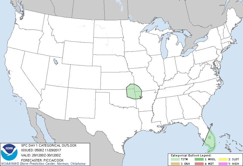
   SPC AC 290508

   Day 1 Convective Outlook
   NWS Storm Prediction Center Norman OK
   1108 PM CST Tue Nov 28 2017

   Valid 291200Z - 301200Z

   ...NO SEVERE THUNDERSTORM AREAS FORECAST...

   ...SUMMARY...
   Isolated thunderstorms will be possible across the Ozarks early
   Wednesday. A few thunderstorms will also be possible across
   southeast Florida.

   ...Discussion...
   As a compact shortwave trough advances east overnight across the
   southern Plains, it should continue to foster weak mid-level
   buoyancy and isolated thunderstorms. Some convective activity will
   likely persist past 12Z, such that a few thunderstorms will remain
   possible as the impulse approaches the Ozarks. However, as it
   continues to de-amplify through the day, weakening large-scale
   ascent will support a downward trend in thunderstorms.

   Across southeast Florida, a combination of modest surface-based
   buoyancy and weak ascent associated with minor vorticity maxima over
   the region will likely encourage a few thunderstorms through the
   period.

   ..Picca/Cook.. 11/29/2017

   CLICK TO GET WUUS01 PTSDY1 PRODUCT

   NOTE: THE NEXT DAY 1 OUTLOOK IS SCHEDULED BY 1300Z