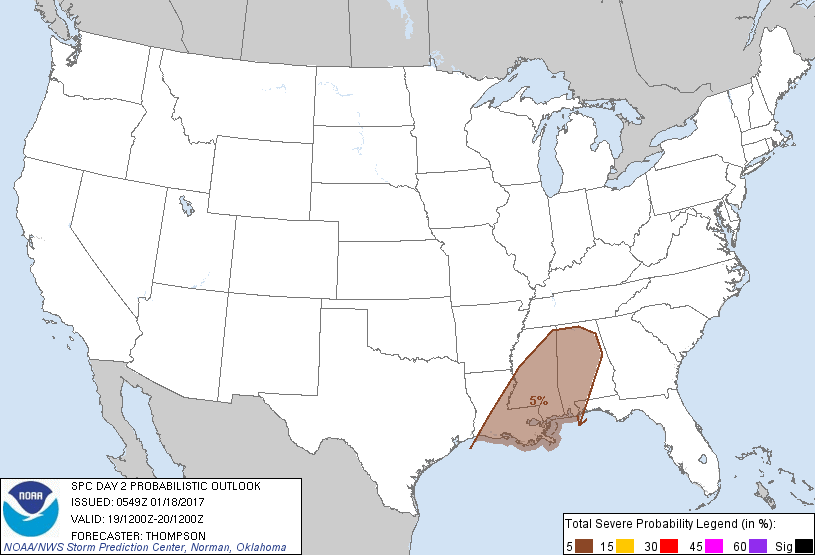
New Orleans, LA...Birmingham, AL...Baton Rouge, LA...Montgomery, AL...Mobile, AL...
Probabilistic Graphic
Probability of severe weather within 25 miles of a point. Hatched Area: 10% or greater probability of significant severe within 25 miles of a point.
Day 2 Prob. Risk
Area (sq. mi.)
Area Pop.
Some Larger Population Centers in Risk Area
5 %
108,488
9,738,865
New Orleans, LA...Birmingham, AL...Baton Rouge, LA...Montgomery, AL...Mobile, AL...
   SPC AC 180549

   Day 2 Convective Outlook
   NWS Storm Prediction Center Norman OK
   1149 PM CST Tue Jan 17 2017

   Valid 191200Z - 201200Z

   ...THERE IS A MARGINAL RISK OF SEVERE THUNDERSTORMS THROUGH THURSDAY
   EVENING FOR PARTS OF THE LOWER MS AND TN VALLEYS...

   ...SUMMARY...
   A marginal severe threat will be possible across parts of the Lower
   Mississippi and Tennessee Valleys on Thursday.

   ...Lower Mississippi Valley...
   A southern-stream shortwave trough over NM and northern Mexico late
   this evening will eject northeastward from TX to the lower MS Valley
   Thursday, and reach the TN/OH Valleys Thursday night, in response to
   an upstream trough crossing CA.  The TX trough will induce weak
   cyclogenesis along a pre-existing front that will extend from
   southeast TX to the Mid South by Thursday afternoon.  A moist air
   mass is already present south of this stalled front, with boundary
   layer dewpoints now near 70 F along the TX coast.  Little overall
   change is expected in low-level trajectories or the character of the
   moist layer across the Gulf basin, so it is likely that 65+ F
   dewpoints will spread and remain inland from the TX coast to at
   least southern LA/MS/AL.

   The ejecting wave/weak cyclogenesis interacting with the moist warm
   sector will support clusters of thunderstorms through the period,
   some of which will likely be ongoing at the beginning of the period
   from southeast TX into LA.  The early convection and clouds through
   the day could limit surface heating as well as midlevel lapse rates,
   thus the magnitude of buoyancy is somewhat in question across the
   lower MS Valley.  Still, any recovery during the day, in combination
   with increasing vertical shear, will support some risk for embedded
   supercells or line segments with isolated damaging winds and perhaps
   a tornado.  The severe risk should be focused during the day across
   LA/MS, and into the evening across AL, and then diminish overnight.

   ...CA into western AZ...
   Isolated thunderstorms will be possible along the CA coast, and
   perhaps into parts of the San Joaquin Valley, during the day as the
   midlevel trough and steeper lapse rates progress inland.  A few
   lightning strikes may also occur closer to the lower CO River Valley
   within the left exit region of the mid-upper jet.

   ..Thompson.. 01/18/2017

   CLICK TO GET WUUS02 PTSDY2 PRODUCT

   NOTE: THE NEXT DAY 2 OUTLOOK IS SCHEDULED BY 1730Z