SPC AC 060651
Day 2 Convective Outlook
NWS Storm Prediction Center Norman OK
1251 AM CST Mon Mar 06 2017
Valid 071200Z - 081200Z
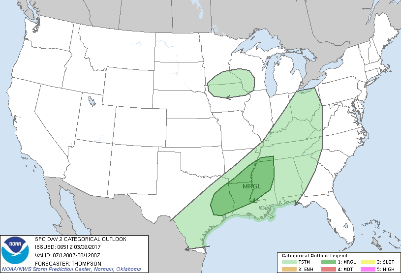
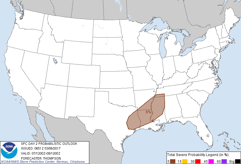
...THERE IS A MARGINAL RISK OF SEVERE THUNDERSTORMS FROM EAST TX TO
THE ARK-LA-MISS...
...SUMMARY...
Isolated strong/severe storms will be possible Tuesday from east
Texas to the Ark-La-Miss and vicinity.
...Ark-La-Miss to east Texas during the day...
A pronounced mid-upper trough now progressing inland over the Great
Basin will continue generally eastward to the central/northern
Plains by tonight and then the Great Lakes and OH Valley by Tuesday.
An associated cold front will move to near the Appalachians by
Tuesday evening, and gradually slow in its southeastward motion by
early Wednesday across the Gulf states. Moisture return ahead of
the cold front is already underway across the northwest Gulf and
southern Plains, with boundary-layer dewpoints in the upper 60s
already present across southeast TX. This moist boundary layer will
likely be maintained from TX to the lower MS Valley ahead of the
cold front Tuesday, which will combine with daytime heating to
support potentially moderate buoyancy in the warm sector.
Convection will likely be ongoing along the front at the beginning
of the period from extreme northeast TX to western TN/KY.
Additional storm development or maintenance of the ongoing storms is
more probable from the Mid-South into east TX where buoyancy will be
stronger during the day within the right entrance region of the
upper jet. Vertical shear will be sufficient for organized line
segments and supercells early in the period, but should decrease by
late afternoon as the primary synoptic wave moves away to the
northeast. Isolated strong/damaging winds, and perhaps marginally
severe hail, will be the main concerns through the afternoon.
...Upper MS Valley Tuesday afternoon...
There will be a low-probability risk for low-topped thunderstorms
Tuesday afternoon along the path of the primary synoptic wave across
northern IA/southern MN into WI. Low-level moisture will be quite
limited, but steep lapse rates and daytime heating could drive
sufficient buoyancy for weak convection with a few lightning
flashes. Steep low-level lapse rates could aid downward momentum
transfer, though any strong/damaging wind risk appears too marginal
for an outlook area at this time.
..Thompson.. 03/06/2017
CLICK TO GET WUUS02 PTSDY2 PRODUCT
NOTE: THE NEXT DAY 2 OUTLOOK IS SCHEDULED BY 1730Z