SPC AC 230541
Day 2 Convective Outlook
NWS Storm Prediction Center Norman OK
1241 AM CDT Sun Apr 23 2017
Valid 241200Z - 251200Z
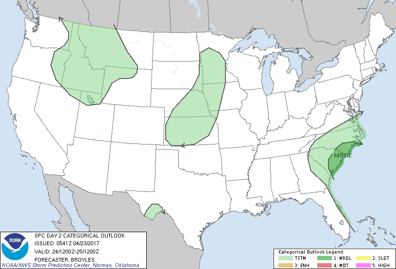
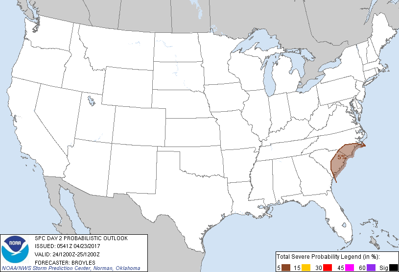
...THERE IS A MARGINAL RISK OF SEVERE THUNDERSTORMS ACROSS PARTS OF
EASTERN SOUTH CAROLINA INTO SOUTHERN NORTH CAROLINA...
...SUMMARY...
Thunderstorms associated with a marginal wind-damage threat will be
possible on Monday across parts of eastern South Carolina and
southern North Carolina.
...Eastern South Carolina/Southern North Carolina...
An upper-level low is forecast to move eastward across central
Georgia to the Atlantic coast on Monday. At the surface, a low is
forecast to deepen and move off the coast from South Carolina. A
cold front trailing the surface low, is forecast to move into the
coastal sections of South Carolina by Monday afternoon. Thunderstorm
development appears likely to take place along the front in eastern
South Carolina with convection expanding northeastward with time
during the afternoon as the surface low remains offshore but moves
toward the coast of North Carolina. NAM forecast soundings from
Charleston, South Carolina to Wilmington, North Carolina for Monday
afternoon show weak instability (MLCAPE of 400 to 600 J/kg) with 0-6
km shear of 25 to 35 kt. This combined with surface dewpoints in the
mid 60s F may be enough for marginally severe wet downbursts with
the stronger multicells.
..Broyles.. 04/23/2017
CLICK TO GET WUUS02 PTSDY2 PRODUCT
NOTE: THE NEXT DAY 2 OUTLOOK IS SCHEDULED BY 1730Z