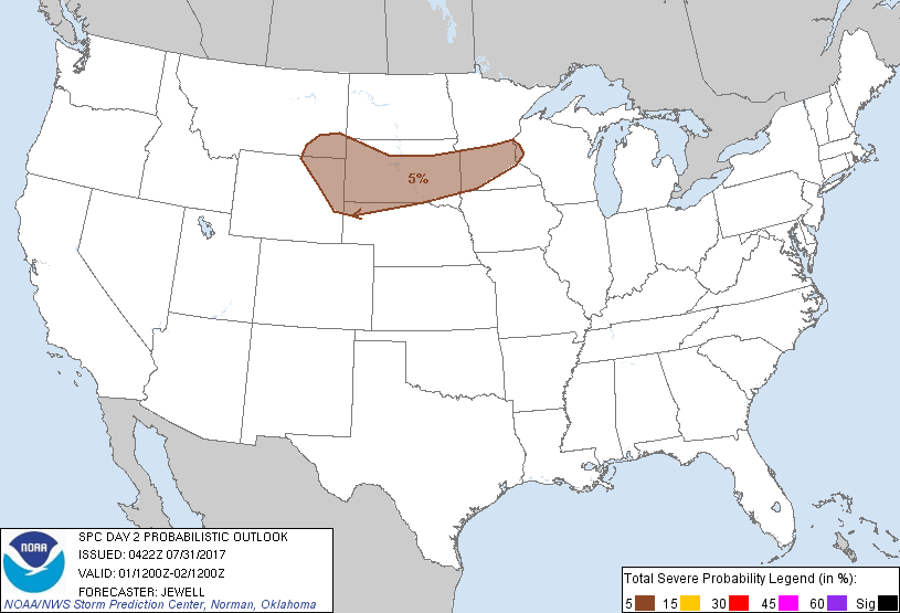
Minneapolis, MN...St. Paul, MN...Sioux Falls, SD...Bloomington, MN...Plymouth, MN...
Probabilistic Graphic
Probability of severe weather within 25 miles of a point. Hatched Area: 10% or greater probability of significant severe within 25 miles of a point.
Day 2 Prob. Risk
Area (sq. mi.)
Area Pop.
Some Larger Population Centers in Risk Area
5 %
112,469
4,591,877
Minneapolis, MN...St. Paul, MN...Sioux Falls, SD...Bloomington, MN...Plymouth, MN...
SPC AC 310422
Day 2 Convective Outlook
NWS Storm Prediction Center Norman OK
1122 PM CDT Sun Jul 30 2017
Valid 011200Z - 021200Z
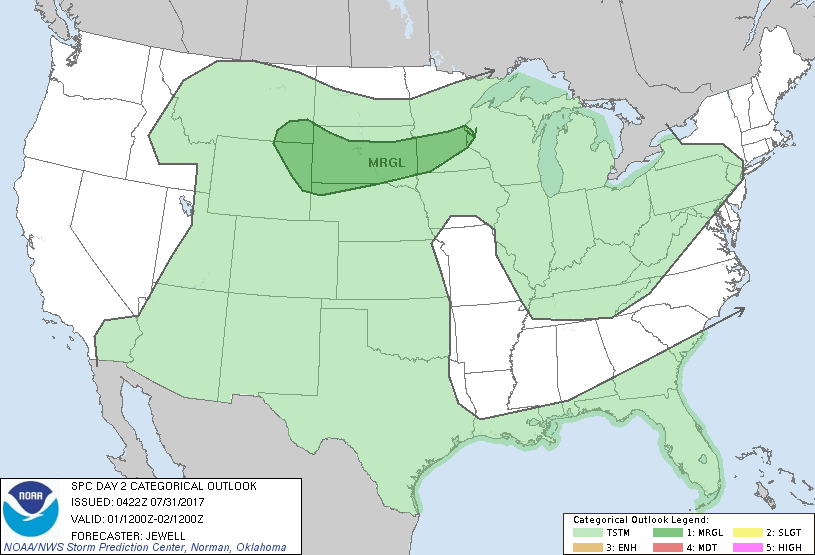
...THERE IS A MARGINAL RISK OF SEVERE THUNDERSTORMS FROM THE
NORTHERN HIGH PLAINS EASTWARD INTO SOUTHERN MINNESOTA...
...SUMMARY...
Isolated severe thunderstorms capable of hail or wind are expected
from southeast Montana and eastern Wyoming eastward into southern
Minnesota on Tuesday.
...Synopsis...
Cool temperatures aloft will spread southward across the northern
Plains and Great Lakes with an upper low over Hudson Bay. Midlevel
flow around 30-35 kt will develop over the northern Rockies and High
Plains as a shortwave trough arrives from the north late. Cool air
aloft will also exist into the Southeast, where a weaker southern
stream upper jet will exist. To the west, an upper high will remain
centered over the Great Basin.
At the surface, a weak boundary/wind shift will drift southward
across the northern Plains, with mainly 50s F dewpoints present as a
result of a persistent surface high to the southeast. Light easterly
surface winds beneath northwesterlies aloft will create shear
marginally favorable for severe storms. Daytime storms will persist
across the Four Corners states, as well as across Florida where
ample moisture will exist south of a stationary front.
...Northern Plains vicinity...
Strong heating beneath cool profiles aloft will lead to ample
instability for strong to severe storms despite deep-layer effective
shear around 30-35 kt. Several clusters of storms are expected to
form during the afternoon near the front and over the Black Hills,
with a few strong storms by evening into southern MN. In addition,
overnight activity is possible into southeast MT, ahead of the
shortwave trough and where a nocturnal increase in southeasterly
low-level winds may favor an isolated severe storm. Large hail
and/or downbursts are most likely across all areas, with the best
chance of a supercell over western areas.
..Jewell.. 07/31/2017
CLICK TO GET WUUS02 PTSDY2 PRODUCT
NOTE: THE NEXT DAY 2 OUTLOOK IS SCHEDULED BY 1730Z