SPC AC 060448
Day 2 Convective Outlook
NWS Storm Prediction Center Norman OK
1148 PM CDT Sat Aug 05 2017
Valid 071200Z - 081200Z
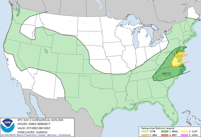
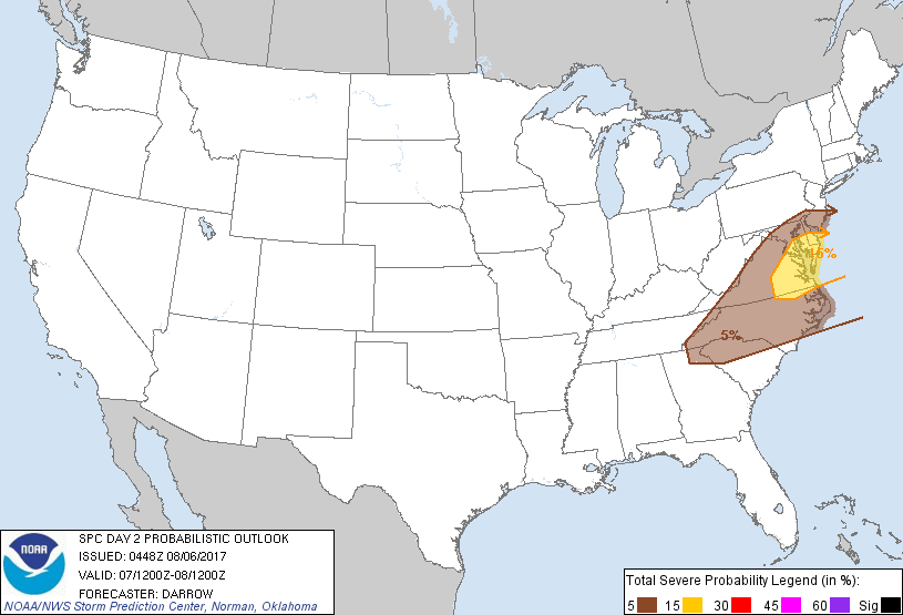
...THERE IS A SLIGHT RISK OF SEVERE THUNDERSTORMS ACROSS PORTIONS OF
THE MIDDLE ATLANTIC...
...THERE IS A MARGINAL RISK OF SEVERE THUNDERSTORMS FROM THE
SOUTHERN APPALACHIANS TO SOUTHERN NJ...
...SUMMARY...
Scattered thunderstorms with some severe potential are expected
across the Middle Atlantic Monday. Isolated strong to severe storms
may develop south into the southern Appalachians.
...Middle Atlantic/Carolinas...
Weak mid-level height falls will spread across the OH Valley into
the Middle Atlantic region Monday ahead of a short-wave trough that
will progress to a position from the Hudson Valley into eastern PA
by 08/12z. Southern extent of strong 500mb flow (on the order of
50kt) will extend into the Delmarva region which is expected to
induce surface cyclogenesis that will translate off the Middle
Atlantic coast into southern New England during the overnight hours.
00z NAM guidance is quite aggressive with this feature with strong
shear expected to develop across the Middle Atlantic ahead of
associated cold front. Forecast soundings across this region exhibit
strong warm advection profiles with 50kt flow developing as low as
850mb. Convection will likely be ongoing along the front at daybreak
Monday with extensive clouds/precip expected to inhibit boundary
layer heating across this region. As a result, weak buoyancy and
poor mid-level lapse rates (5.5C/km) will likely prove detrimental
to updraft strength for storms that develop across this region. Even
so, strongly sheared storms could certainly produce isolated
damaging winds, especially if breaks can develop across the warm
sector allowing for some surface heating.
..Darrow.. 08/06/2017
CLICK TO GET WUUS02 PTSDY2 PRODUCT
NOTE: THE NEXT DAY 2 OUTLOOK IS SCHEDULED BY 1730Z