SPC AC 271709
Day 2 Convective Outlook
NWS Storm Prediction Center Norman OK
1209 PM CDT Sun Aug 27 2017
Valid 281200Z - 291200Z
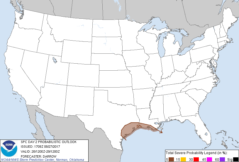
...THERE IS A SLIGHT RISK OF SEVERE THUNDERSTORMS ACROSS THE UPPER
TX COAST...
...THERE IS A MARGINAL RISK OF SEVERE THUNDERSTORMS ACROSS PORTIONS
OF THE COASTAL PLAIN OF TX INTO SOUTHERN LA...
...SUMMARY...
Some tornado threat should persist through Monday across the middle
and upper Texas coastal plain region, and perhaps into portions of
southern Louisiana associated with Harvey.
...Harvey...
Latest short-range model guidance continues to suggest Harvey will
meander about the coastal plain of TX with a slow southeast movement
possible into the day2 period. If Harvey shifts a bit southeast it
will become increasingly difficult for strong buoyancy to develop
very far inland as an expansive precip shield should hold across
immediate interior regions. Will maintain 5% severe probs for a few
tornadoes, especially across the upper TX coast where greatest
corridor of instability is expected to overlap with more favorable
shear. Reference NHC for more information on Harvey.
...Southeast Coast...
12z model guidance suggest a weak surface low will drift across the
northern FL Peninsula off the GA coast by 28/12z. Short-range
guidance is fairly consistent with this feature ejecting northeast,
just offshore, perhaps skirting the Outer Banks region of NC toward
the end of the period. While this feature may strengthen during the
latter half of the period it appears buoyancy will be quite limited
along the Carolina coast and the probability for severe in
association with this developing system should remain low given the
forecast shear profiles. Reference NHC for more information
regarding this evolving system.
..Darrow.. 08/27/2017
CLICK TO GET WUUS02 PTSDY2 PRODUCT
NOTE: THE NEXT DAY 2 OUTLOOK IS SCHEDULED BY 0600Z