SPC AC 021729
Day 2 Convective Outlook
NWS Storm Prediction Center Norman OK
1229 PM CDT Sat Sep 02 2017
Valid 031200Z - 041200Z
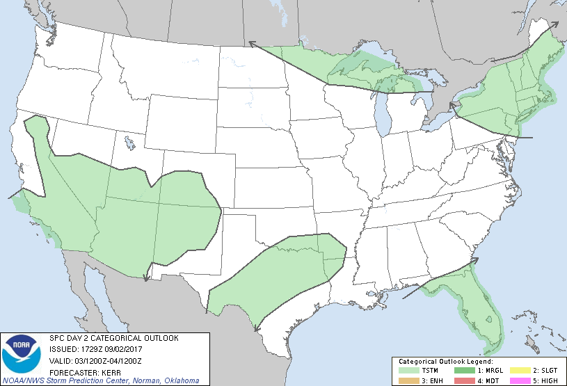
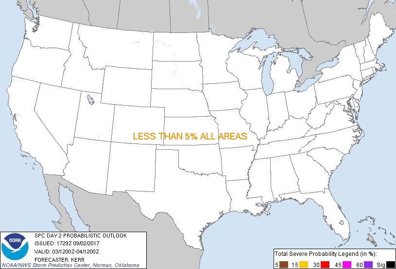
...NO SEVERE THUNDERSTORM AREAS FORECAST...
...SUMMARY...
The risk of severe thunderstorms appears negligible (i.e., severe
probabilities less than 5 percent) across the U.S., Sunday through
Sunday night.
...Synopsis...
Subtropical ridging appears likely to remain prominent across much
of the West through this period, generally centered along an axis
extending from the Cascades through the southern Rockies. On its
southwestern periphery, a weakening tropical cyclone (Lidia) is
forecast to progress slowly northwest of Baja. This probably will
be accompanied by an influx of seasonably high moisture content air
into at least portions of the southwestern deserts and southern
California.
To the north, models suggest that the mid-latitude westerlies may
become increasing amplified across the northeastern Pacific into
western North America, with large-scale ridging building across the
Pacific Northwest, British Columbia and the Yukon Territory,
downstream of digging large-scale troughing. East of this feature,
mid/upper flow is forecast to trend increasingly cyclonic across the
Canadian prairies through the central Canadian/U.S. border area, as
the center of a significant cyclone begins to shift/reform south of
Hudson Bay. As this occurs, a vigorous downstream short wave trough
is expected to pivot northeastward, from the lower Great Lakes/upper
Ohio Valley through much of the Northeast. Models suggest that the
increasingly sheared mid-level remnants of Harvey will become
absorbed within the cyclonic flow to the east of this latter trough
axis, and associated forcing for ascent may contribute to
significant cyclogenesis, which is forecast to take place from
northern Mid Atlantic coastal areas into the Canadian Maritimes
Sunday through Sunday night.
In the wake of the remnants of Harvey, a plume of seasonably high
moisture content air is in the process of slowly advecting east of
the Atlantic Seaboard. A more rapid progression away from the coast
appears likely on Sunday, while the plume also generally remains
suppressed to the south, across the Florida peninsula and
southeastern Gulf of Mexico.
Given seasonably weak to modest moisture availability east of the
Rockies, generally weak destabilization, at least where forcing for
ascent may become supportive of convective development, seems likely
to minimize the risk for severe storms.
...Northeast...
In the wake of considerable early period cloud cover and
precipitation, insolation beneath the mid-level cold pool associated
with the short wave impulse pivoting across the region may
contribute to widely scattered thunderstorms from the lee of the
lower Great Lakes into north Atlantic coastal areas Sunday. Models
suggest that the warm sector of the deepening surface cyclone could
overspread southeast New England coastal areas late Sunday
afternoon. Given potentially strong vertical shear within this
regime, severe weather potential may be non-zero given at least weak
boundary layer destabilization, but due to the highly conditional
nature of this risk, severe probabilities still appear below 5
percent.
...Northeastern Minnesota...
A regime characterized by strengthening deep layer wind fields/shear
and lower/mid tropospheric warm advection, ahead of a significant
southward advancing cold front, near or shortly after peak heating,
could potentially become supportive of vigorous thunderstorm
development Sunday afternoon and evening across the Minnesota
Arrowhead vicinity. However, at this time, it remains unclear that
destabilization will become supportive of much beyond isolated storm
development, and probabilities for severe hail and wind still appear
to remain below 5 percent.
..Kerr.. 09/02/2017
CLICK TO GET WUUS02 PTSDY2 PRODUCT
NOTE: THE NEXT DAY 2 OUTLOOK IS SCHEDULED BY 0600Z
|