SPC AC 220442
Day 2 Convective Outlook
NWS Storm Prediction Center Norman OK
1042 PM CST Thu Dec 21 2017
Valid 231200Z - 241200Z
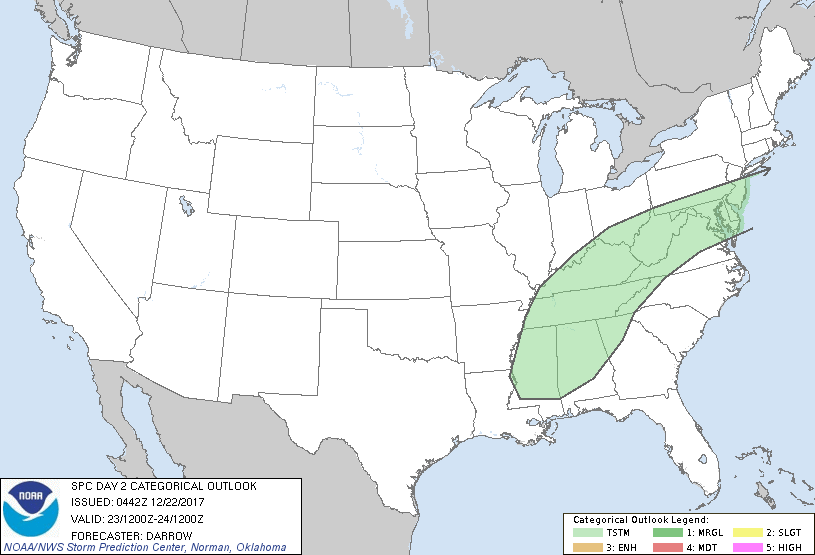
...NO SEVERE THUNDERSTORM AREAS FORECAST...
...SUMMARY...
Some thunderstorm potential will exist from the Mid-South into the
Middle Atlantic region Saturday.
...Discussion...
Strong short-wave trough over the southwestern US will eject across
the southern Plains day1 then deamplify as it translates across the
TN Valley into the Middle Atlantic by 24/00z. This feature will
encourage a seasonally moist plume of modified Gulf air to stream
across the mid-South ahead of a surging cold front. Latest
short-range model guidance suggests significant large-scale forcing
for ascent will spread ahead of the short wave where mid-level
height falls are expected to focus. Forecast soundings exhibit
modest mid-level lapse rates along a corridor from TN into the
Delmarva which should contribute to adequate buoyancy for elevated
convection. Updrafts will likely be rooted primarily near 850mb and
the deepest convection could attain heights necessary for lightning
discharge. For this reason have extended thunder probabilities into
the Middle Atlantic where strongest forcing will be observed ahead
of the short wave/surface low track.
..Darrow.. 12/22/2017
CLICK TO GET WUUS02 PTSDY2 PRODUCT
NOTE: THE NEXT DAY 2 OUTLOOK IS SCHEDULED BY 1730Z
|