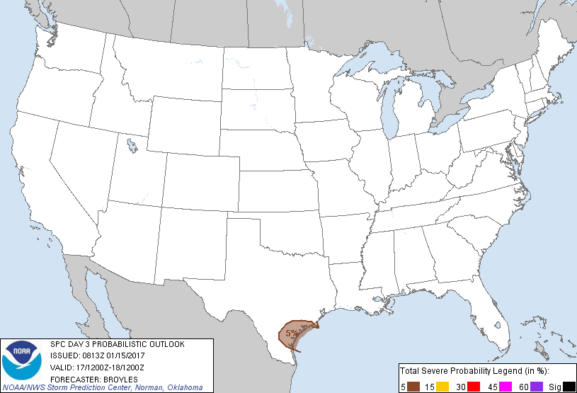
Corpus Christi, TX...Victoria, TX...Kingsville, TX...Alice, TX...Portland, TX...
Probabilistic Graphic
Probability of severe weather within 25 miles of a point. Hatched Area: 10% or greater probability of significant severe within 25 miles of a point.
Day 3 Prob. Risk
Area (sq. mi.)
Area Pop.
Some Larger Population Centers in Risk Area
5 %
12,864
715,516
Corpus Christi, TX...Victoria, TX...Kingsville, TX...Alice, TX...Portland, TX...
SPC AC 150813
Day 3 Convective Outlook
NWS Storm Prediction Center Norman OK
0213 AM CST Sun Jan 15 2017
Valid 171200Z - 181200Z
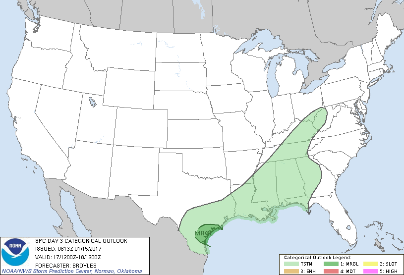
...THERE IS A MARGINAL RISK OF SEVERE THUNDERSTORMS ACROSS PARTS OF
THE LOWER TO MIDDLE TEXAS COAST...
...SUMMARY...
A marginal severe threat will be possible in the Texas Coastal
Plains near and to the north of Corpus Christi, Texas on Tuesday.
...Lower to Middle Texas Coastal Plains...
An upper-level low near Baja California is forecast to move slowly
eastward on Tuesday as southwest mid-level flow remains located
across the southern Plains. A cold front is forecast to move slowly
southward to the lower to middle Texas coast by Tuesday afternoon
with surface dewpoints in the coastal areas remaining in the 60s F.
Some instability may develop by afternoon south of the front mainly
in the vicinity of Corpus Christi. NAM forecast soundings in this
area at 21Z on Tuesday show surface dewpoints in the mid 60s F,
SBCAPE near 500 J/kg and 0-6 km shear of 55 to 60 kts. This may be
enough for a potential for hail and marginally severe wind gusts
with surface based storms that develop along and just to the south
of the front. The area with the greatest potential for marginally
severe convection will depend upon the exact position of the cold
front by Tuesday afternoon.
..Broyles.. 01/15/2017
CLICK TO GET WUUS03 PTSDY3 PRODUCT
NOTE: THE NEXT DAY 3 OUTLOOK IS SCHEDULED BY 0830Z