SPC AC 130819
Day 3 Convective Outlook
NWS Storm Prediction Center Norman OK
0219 AM CST Mon Feb 13 2017
Valid 151200Z - 161200Z
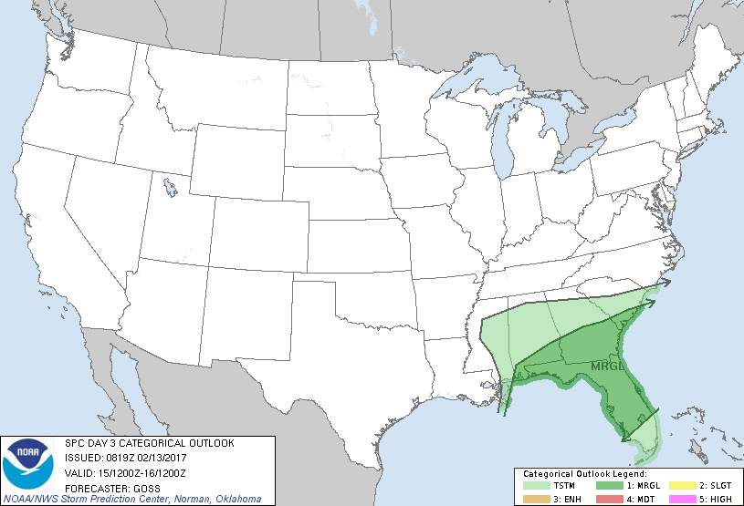
...THERE IS A MARGINAL RISK OF SEVERE THUNDERSTORMS ACROSS PORTIONS
OF THE SOUTHEAST...
...SUMMARY...
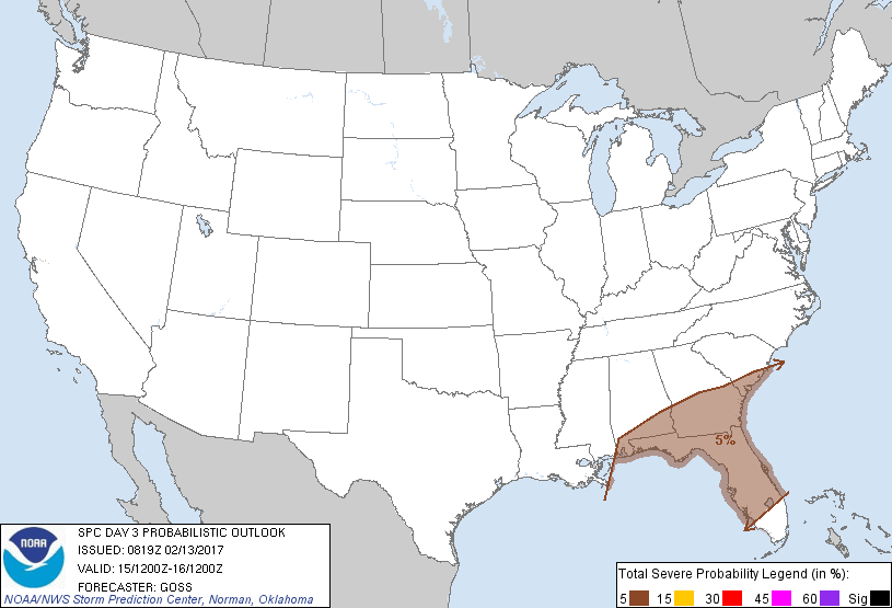
Showers and scattered thunderstorms are forecast across parts of the
southeast U.S. Wednesday, with a few severe storms possible from
southern parts of Alabama, Georgia, and South Carolina southward
across Florida.
...Synopsis...
Large-scale ridging aloft is forecast to persist across western
North America Day 3/Wednesday, while an eastern U.S. trough
continues moving slowly eastward. A smaller/southern-stream wave
will cross the central Gulf coastal region early in the period, and
continue to become absorbed within the larger-scale northern-stream
troughing over the East.
At the surface, high pressure is progged to affect much of the
country, though lee troughing in the vicinity of the High Plains is
forecast to persist/drift east through the period. Otherwise, a low
associated with the weakening southern-stream perturbation will
cross the southeast U.S. during the day, while a trailing cold front
shifts across the western and central Gulf of Mexico, and eventually
southeastward across much of Florida through the end of the period.
...The Southeast...
Largely elevated showers and a few thunderstorms are progged to be
ongoing at the start of the period, with any surface-based storms
likely confined to the southern AL/FL Panhandle vicinity. As the
surface low moves eastward across the area through the day (the
timing of which differs fairly substantially amongst the different
models), limited surface-based severe potential should spread across
southern GA and possibly southern SC. All severe hazards appear
possible, though risk appears limited overall at this time.
Farther south into the Florida Peninsula, severe risk should
increase into the evening/overnight, as the cold front shifts
southward. While somewhat veered boundary-layer flow ahead of the
front is expected, limiting low-level veering/shear to some degree,
low-end threat for all-hazard severe weather is expected to linger
until frontal passage (the timing of which being uncertain due to
fairly substantial aforementioned model differences).
..Goss.. 02/13/2017
CLICK TO GET WUUS03 PTSDY3 PRODUCT
NOTE: THE NEXT DAY 3 OUTLOOK IS SCHEDULED BY 0830Z