SPC AC 010727
Day 3 Convective Outlook
NWS Storm Prediction Center Norman OK
0227 AM CDT Mon May 01 2017
Valid 031200Z - 041200Z
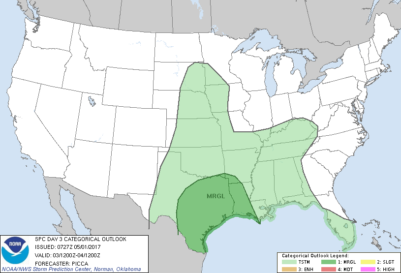
...THERE IS A MARGINAL RISK OF SEVERE THUNDERSTORMS FROM
CENTRAL/SOUTHERN TEXAS EASTWARD TO LOUISIANA...
...SUMMARY...
A few severe storms will be possible from central/southern Texas
eastward to Louisiana on Wednesday.
...Synopsis...
With multiple shortwave impulses progressing east/southeast across
the central US, a longer-wave trough will gradually amplify across
the Plains states and Mississippi Valley through Wednesday night.
Meanwhile, upstream ridging will overspread the Inter-Mountain West.
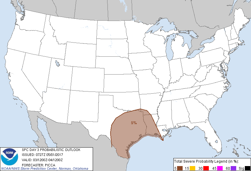
...Central/southern Texas eastward to parts of Louisiana...
In response to a weak shortwave trough embedded in the southern
stream, convection will likely be ongoing/expanding across parts of
southeast Texas and potentially southwest Louisiana on Wednesday
morning. With a plume of relatively steep mid-level lapse rates over
much of the region and a veering wind profile with height, stronger
cores may be capable of a few severe hail reports early in the day.
Additionally, a tornado may be possible near a warm front close to
the upper Texas Coast / Sabine Valley, where any surface-based
updrafts would encounter enhanced storm-relative helicity. Of note,
most guidance has trended westward and slightly narrower with the
warm/moist sector supportive of such surface-based development.
Considering ample subsidence/drying behind the current highly
amplified central/eastern US system, this trend does not appear
unreasonable. As such, confidence in anything more than marginal
severe probabilities remains low for this early convection.
Farther north, weak warm advection and/or convergence along a front
pushing east/southeast will likely encourage convection across parts
of north Texas eastward to the Ark-La-Tex through the morning and
afternoon hours. Modest mid-level flow and weak/moderate buoyancy
will likely yield a threat for a few instances of severe hail and
perhaps strong wind gusts.
More substantial buoyancy will likely materialize across portions of
central/southern Texas during the afternoon hours, as surface dew
points in the upper 60s/lower 70s combine with diurnal heating to
yield upwards of 2000-3000 J/kg of MLCAPE. While some guidance
suggests even greater buoyancy potential, the aforementioned
early-day convection offers uncertainty regarding this upper-end
scenario. Furthermore, weakened/veered 850-700mb flow in the wake of
the initial impulse appears somewhat unfavorable for widespread
organized updrafts. As such, thunderstorms are forecast to develop
into clusters/segments along the cold front pushing southeast
Wednesday afternoon/evening, with the potential for at least a few
instances of large hail and strong winds. Considering the potential
for moderate/strong buoyancy, some portions of the region could be
upgraded to a Slight Risk in later outlooks as mesoscale details
become clearer.
..Picca.. 05/01/2017
CLICK TO GET WUUS03 PTSDY3 PRODUCT
NOTE: THE NEXT DAY 3 OUTLOOK IS SCHEDULED BY 0730Z