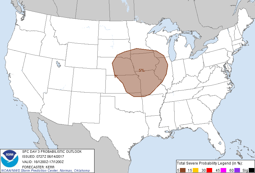
Kansas City, MO...Omaha, NE...Wichita, KS...St. Louis, MO...Lincoln, NE...
Probabilistic Graphic
Probability of severe weather within 25 miles of a point. Hatched Area: 10% or greater probability of significant severe within 25 miles of a point.
Day 3 Prob. Risk
Area (sq. mi.)
Area Pop.
Some Larger Population Centers in Risk Area
5 %
259,414
17,199,497
Kansas City, MO...Omaha, NE...Wichita, KS...St. Louis, MO...Lincoln, NE...
SPC AC 140727
Day 3 Convective Outlook
NWS Storm Prediction Center Norman OK
0227 AM CDT Wed Jun 14 2017
Valid 161200Z - 171200Z
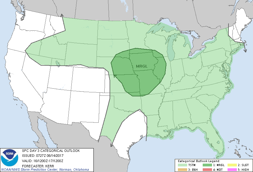
...THERE IS A MARGINAL RISK OF SEVERE THUNDERSTORMS ACROSS THE MID
AND LOWER MISSOURI VALLEY AND SURROUNDING PORTIONS OF THE CENTRAL
PLAINS AND MIDDLE MISSISSIPPI VALLEY...
...SUMMARY...
Thunderstorms may impact the mid and lower Missouri Valley, and
adjacent areas of the interior U.S., Friday through Friday night,
accompanied by at least some risk for severe weather.
...Discussion...
Some expansion of general mid-level ridging appears possible across
the subtropical eastern Pacific and northern Mexico into the
southwestern states during this period, with ridging also building
northward within the mid-latitude westerlies, to the west of the
Pacific Northwest coast. Downstream, models suggest that the
westerlies will trend broadly cyclonic and west northwesterly across
the northern intermountain region, Rockies and Plains, into the
upper Mississippi Valley. A significant short wave impulse within
this regime may progress across the northern intermountain region
and Rockies into the Plains by the end of the period, but this may
be preceded by a couple of less prominent impulses across parts of
the northern Plains and upper Mississippi Valley region Friday into
Friday night.
Along the southern fringe of the westerlies, the northern periphery
of a plume of very warm elevated mixed layer air may initially surge
northward into the mid and lower Missouri Valley region during the
day Friday. This appears likely to coincide with a northward return
of seasonably moist low-level air, which models suggest will
contribute to a sizable area of moderate to strong potential
instability.
Given this environment, vigorous thunderstorm development, including
discrete supercells and evolving/organizing thunderstorm clusters
appear at least possible throughout the period. An initial
perturbation may be supporting thunderstorm activity at the outset
of the period across parts of the mid Missouri Valley into the Upper
Midwest. The details of subsequent boundary layer destabilization
to the east/south and west may hinge on the convective evolution
across the central Plains Thursday night, which remains uncertain at
this time. However, an upstream impulse may also eventually
contribute to forcing for new thunderstorm development across the
mid into lower Missouri Valley region late Friday afternoon and
evening, generally within stronger lower/mid tropospheric warm
advection on the nose of the capping elevated mixed layer air.
The latter activity, coinciding with peak diurnal destabilization
seems to have the greatest potential for considerable upscale growth
and associated severe weather potential. However, uncertainties for
even this development (largely due to sub-synoptic scale
developments) still seem too large to outlook more than 5 percent
severe probabilities at this time.
..Kerr.. 06/14/2017
CLICK TO GET WUUS03 PTSDY3 PRODUCT
NOTE: THE NEXT DAY 3 OUTLOOK IS SCHEDULED BY 0730Z