SPC AC 220731
Day 3 Convective Outlook
NWS Storm Prediction Center Norman OK
0231 AM CDT Thu Jun 22 2017
Valid 241200Z - 251200Z
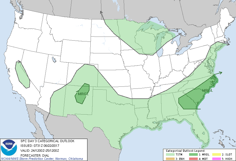
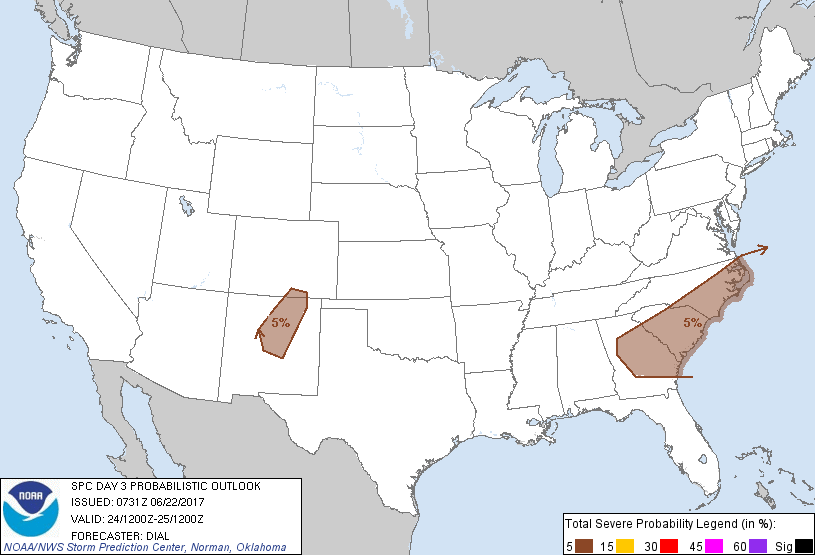
...THERE IS A MARGINAL RISK OF SEVERE THUNDERSTORMS OVER A PORTION
OF THE CAROLINAS...
...THERE IS A MARGINAL RISK OF SEVERE THUNDERSTORMS OVER A PORTION
OF THE SOUTHERN ROCKIES...
...SUMMARY...
While isolated strong storms with gusty winds are possible over
portions of the Gulf Coast states Saturday, organized severe storms
are not expected.
...Synopsis...
Synoptic pattern will become dominated by an upper trough over the
eastern two thirds of the country with an upper ridge extending from
the southwest states into the Pacific Northwest. A cold front will
move off the Atlantic seaboard early in the period, but the
southwestern extension of this boundary will stall from the
Southeast States into the southern Plains.
...Southeast States through the southern Plains...
Showers and thunderstorms will redevelop along and south of the
stalled front where the atmosphere will become moderately unstable
during the day. Weak winds aloft and weak vertical shear will
promote pulse and multicell storms. Though organized storms are not
expected, a few wet downbursts will be possible through early
evening. Have introduced a marginal area over a portion of the
Carolinas where winds aloft will be somewhat stronger along the
southern periphery of the upper trough and potential for greater
destabilization exists.
...Southern Rockies...
Steep mid-level lapse rates and diabatic heating over the higher
terrain will contribute to potential for a few thunderstorms to
develop over the southern Rockies. This region will reside along the
southern fringe of moderate northwesterly winds aloft with
sufficient shear for a few storms to develop mid-level updraft
rotation. Storms developing in this area will have potential to
produce downburst winds and marginally severe hail.
...Mid Atlantic area...
Convection may be ongoing early Saturday over portion of VA into MD
in association with remnants of Cindy that will be extratropical by
that time. While this activity will be embedded within strong wind
fields, very weak instability should limit an organized severe
threat.
..Dial.. 06/22/2017
CLICK TO GET WUUS03 PTSDY3 PRODUCT
NOTE: THE NEXT DAY 3 OUTLOOK IS SCHEDULED BY 0730Z