SPC AC 270651
Day 3 Convective Outlook
NWS Storm Prediction Center Norman OK
0151 AM CDT Sun Aug 27 2017
Valid 291200Z - 301200Z
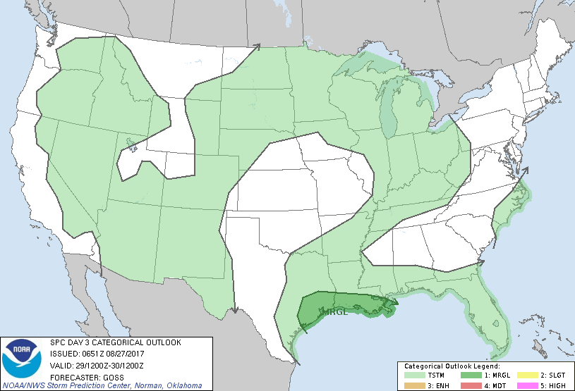
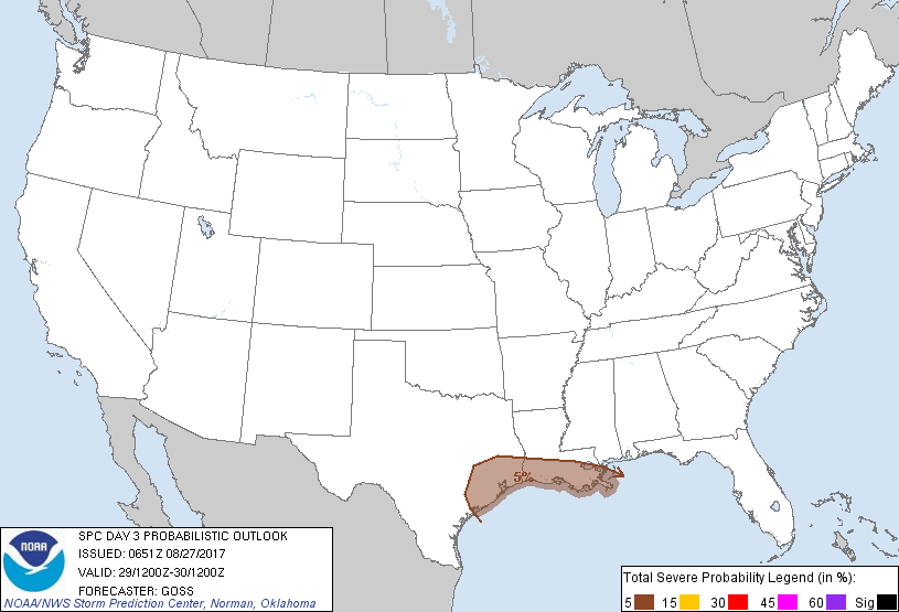
...THERE IS A MARGINAL RISK OF SEVERE THUNDERSTORMS ACROSS PORTIONS
OF THE TEXAS AND LOUISIANA GULF COAST...
...SUMMARY...
Risk for a couple of tornadoes may persist across portions of the
western Gulf Coast region, dependent upon increasingly uncertain
movement of Harvey.
...Synopsis...
No major change in the overall upper flow field is forecast for
Tuesday, with a ridge remaining over the West and a trough in the
East. As short-wave troughing within the broader cyclonic flow
field over the eastern U.S. shifts northeast across the mid-Atlantic
region, a deepening low is forecast to shift north-northeast away
from the NC coast through the period. Meanwhile, a weak cool front
may move inland across the Pacific Northwest ahead of a trough
advancing across the northeast Pacific. Finally, Harvey will likely
linger in the vicinity of coastal Texas through the period.
...Parts of the Texas and Louisiana Gulf Coast areas...
The broad circulation around the center of Harvey will likely
continue to support low-level shear sufficient for some rotation
within stronger convective cells Tuesday, along with
corresponding/limited risk for brief/weak tornadoes. The areal
coverage of this risk becomes increasingly uncertain with time into
the forecast period, as large variation in solutions exists among
various models. Based on the latest official forecast from the NHC,
Harvey will remain over the middle Texas Coastal Plain through
Tuesday, which would keep the main risk for brief tornadic spin-ups
across the middle and upper Texas coast and into portions of coastal
Louisiana.
..Goss.. 08/27/2017
CLICK TO GET WUUS03 PTSDY3 PRODUCT
NOTE: THE NEXT DAY 3 OUTLOOK IS SCHEDULED BY 0730Z