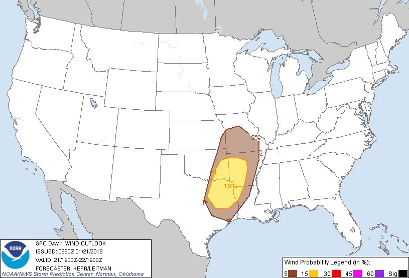
Probability of damaging thunderstorm winds or wind gusts of 50 knots or higher within 25 miles of a point. Hatched Area: 10% of greater probability of wind gusts 65 knots or greater within 25 miles of a point.
SPC AC 210550
Day 1 Convective Outlook
NWS Storm Prediction Center Norman OK
1150 PM CST Sat Jan 20 2018
Valid 211200Z - 221200Z
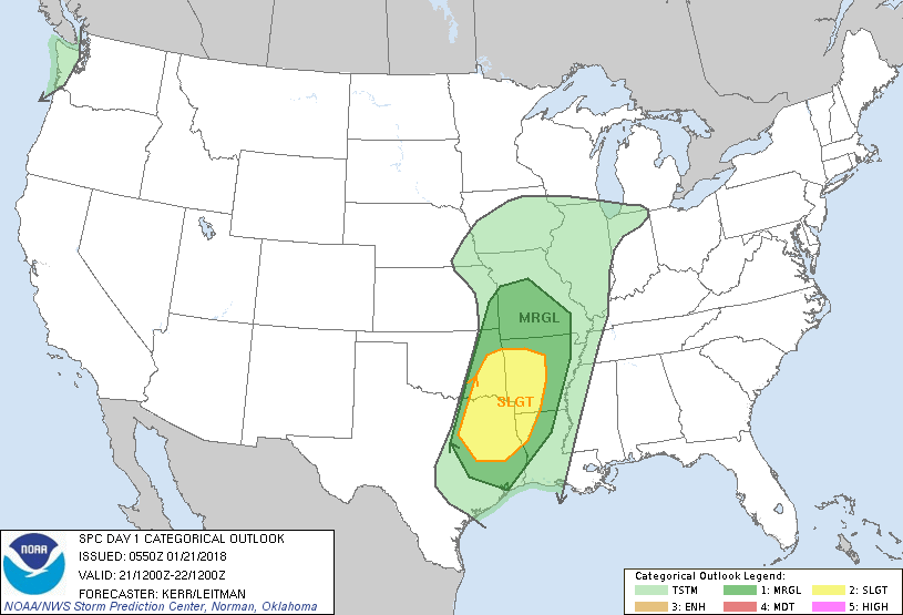
...THERE IS A SLIGHT RISK OF SEVERE THUNDERSTORMS LATE THIS
AFTERNOON INTO TONIGHT ACROSS PARTS OF EASTERN OKLAHOMA AND
NORTHEAST TEXAS INTO WESTERN ARKANSAS AND PARTS OF NORTHWEST
LOUISIANA...
...THERE IS A MARGINAL RISK OF SEVERE THUNDERSTORMS ACROSS
SURROUNDING AREAS OF THE SOUTHEASTERN PLAINS...OZARK PLATEAU...LOWER
MISSISSIPPI VALLEY AND NORTHWEST GULF COAST VICINITY....
...SUMMARY...
Severe thunderstorms are possible late this afternoon into tonight,
mainly across southeastern portions of the Plains into the Ozark
Plateau region, where activity may be accompanied by the risk for
damaging wind gusts and perhaps a couple of tornadoes.
...Synopsis...
Mid/upper flow has become more zonal and progressive across much of
the U.S. and will remain so through this period. While temperatures
have moderated considerably across most areas east of the Rockies,
boundary layer recovery over the Gulf of Mexico is still ongoing.
In the wake of one short wave trough forecast to advance across
parts of the Southeast into the western Atlantic today, seasonably
high moisture content air is generally expected to remain confined
to the Caribbean and southern Gulf of Mexico. However, boundary
layer modification has been sufficient for surface dew point
increases into the lower/mid 60s across portions of the western Gulf
of Mexico into the Texas coastal Plain.
At least some further deepening of this moist boundary layer appears
possible, as a southerly return flow strengthens across the
northwest Gulf coast into portions of the southeastern Plains and
lower/middle Mississippi Valley today into tonight. This is
expected in response to the approach of a large/vigorous short wave
trough, currently advancing into the Four Corners states. As this
feature continues east of the southern Rockies, through the central
and southern Plains, models indicate that significant cyclogenesis
(already underway) will proceed from the Texas/Oklahoma Panhandle
region northeastward through northeastern Kansas/northwestern
Missouri by 12Z Monday. This appears likely to be accompanied by
intensifying wind fields, including 90+ kt at 500 mb and 50-70+ kt
at 850 mb, south through east of the developing lower/mid
tropospheric circulation center.
At the same time, upstream, another vigorous mid-level short wave
trough is forecast to advance inland across the Pacific Northwest
through portions of the northern Rockies, accompanied by areas of
weak destabilization.
...Southeastern Plains into Ozark Plateau/lower Missouri Valley...
Models remain suggestive that the developing cyclone may not be
accompanied by the evolution of a particularly well-defined dryline,
with stronger daytime heating generally occurring to the west of the
plume of modest low-level moisture return. Within this plume,
considerable low cloud cover is expected to inhibit surface heating,
resulting in generally weak near surface lapse rates, particularly
with increasing northward extent to the north of the Red
River/Ark-La-Tex region. Increasing moisture near/above the surface
will still probably result in increasing conditional instability,
and perhaps increasing convection through the day, however
convection likely will initially be capped by relatively warm
elevated mixed-layer air.
Toward late afternoon, erosion of mid-level capping with large-scale
ascent ahead of the approaching short wave may allow for deepening
convection and the development of thunderstorm activity,
particularly across parts of northeast Texas and eastern Oklahoma.
However, guidance appears suggestive that a more substantive
increase, intensification and organization of storms may not occur
until the leading edge of the stronger lower/mid tropospheric
cooling overspreads the more substantive low-level moisture return,
near or perhaps after 22/00z.
Once this occurs, mixed layer CAPE increasing to near or above 500
J/kg across parts of northeast Texas and eastern Oklahoma, in the
presence of strong deep layer flow and shear, is expected to support
a period of increasing severe weather potential continuing
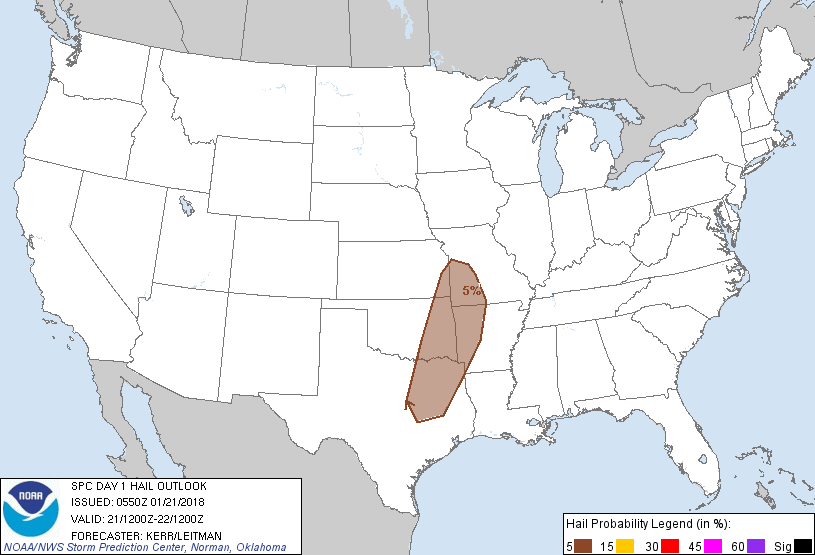
into/through much of this evening. Isolated supercells are possible
early, but the evolution of a squall line may be fairly quick,
spreading eastward toward the Mississippi Valley, and perhaps
northeastward toward the lower Missouri Valley. Forecast sizable
clockwise curved low-level hodographs will contribute to at least
some risk for tornadoes with stronger activity, although this may be
hampered across even the Ark-La-Tex region by neutral to stable
lapse rates within a shallow near surface layer. Given the
convective mode, potentially damaging wind gusts appear the primary
severe threat, as stronger downdrafts aid the downward transfer of
higher momentum to the surface.
..Kerr/Leitman.. 01/21/2018
CLICK TO GET WUUS01 PTSDY1 PRODUCT
NOTE: THE NEXT DAY 1 OUTLOOK IS SCHEDULED BY 1300Z