Probability of damaging thunderstorm winds or wind gusts of 50 knots or higher within 25 miles of a point. Hatched Area: 10% of greater probability of wind gusts 65 knots or greater within 25 miles of a point.
Day 1 Wind Risk
Area (sq. mi.)
Area Pop.
Some Larger Population Centers in Risk Area
15 %
76,105
5,027,960
Shreveport, LA...Little Rock, AR...Mesquite, TX...Tyler, TX...Fort Smith, AR...
SPC AC 220040
Day 1 Convective Outlook
NWS Storm Prediction Center Norman OK
0640 PM CST Sun Jan 21 2018
Valid 220100Z - 221200Z
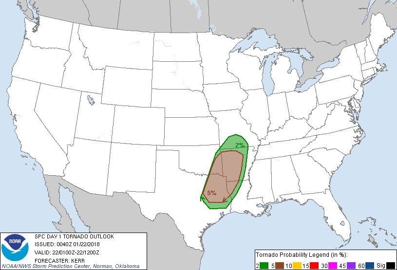
...THERE IS A SLIGHT RISK OF SEVERE THUNDERSTORMS THIS EVENING
ACROSS PARTS OF SOUTHEASTERN OKLAHOMA AND NORTHEASTERN TEXAS INTO
WESTERN/CENTRAL ARKANSAS AND NORTHWESTERN LOUISIANA...
...THERE IS A MARGINAL RISK OF SEVERE THUNDERSTORMS ACROSS
SURROUNDING AREAS OF THE SOUTHEASTERN PLAINS AND MISSISSIPPI
VALLEY...
...SUMMARY...
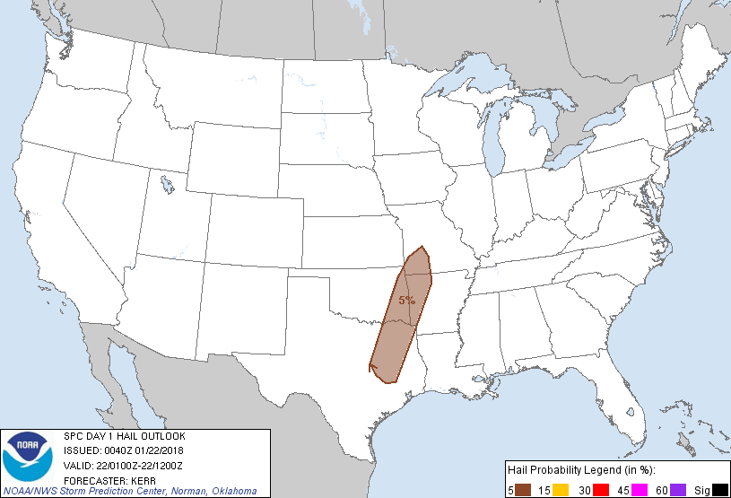
A risk for severe storms capable of producing damaging wind gusts,
and perhaps a couple of tornadoes, continues this evening, mainly
across parts of southeastern Oklahoma and northeastern Texas into
western and central Arkansas and northwestern Louisiana.
...01Z Outlook Update...
Latest model output suggests that a period of more rapid deepening
of the surface cyclone may not be until later this evening into the
overnight hours, across parts of northeastern Kansas into
northwestern Missouri, before it begins to occlude. To this point,
thunderstorm development has been largely confined to the narrow
plume of modest low-level moisture return emanating from the western
Gulf of Mexico, where a combination of relatively warm mid-levels
(allowing for only weak CAPE) and weak low-level lapse rates have
tended to minimize the overall severe weather potential.
There may be little overall change to convective trends for another
couple of hours, before the leading edge of stronger lower/mid
tropospheric cooling begins to overspread the better low-level
moisture return toward the 03-04Z time frame. This may contribute
to at least some further intensification of storms, and perhaps
organization of storms into an evolving squall line.
Although this will coincide with a gradual cooling and
stabilization of the axis of weak boundary layer instability
(supported by daytime heating) across central/eastern Texas into
eastern Oklahoma/western Arkansas, a period of increasing severe
weather potential still appears possible this evening. This may be
primarily in the form of damaging wind gusts, aided by downward
momentum transfer near a southerly 850 mb jet which is forecast to
strengthen to 50-70 kts across the Ark-La-Tex and Ozark Plateau,
through the lower/middle Mississippi Valley. However, sizable
clockwise curved low-level hodographs will also contribute to at
least some risk for tornadoes, particularly with any continuing
discrete storm development. As storms tend to develop eastward into
the lower/middle Mississippi Valley, weaker instability,
particularly in the near surface layer, is expected to result in
diminishing severe weather potential by late tonight.
..Kerr.. 01/22/2018
CLICK TO GET WUUS01 PTSDY1 PRODUCT
NOTE: THE NEXT DAY 1 OUTLOOK IS SCHEDULED BY 0600Z